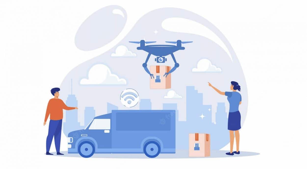
Introduction
The AI behind drone delivery is what turns a noisy quadcopter into a logistics asset that lands a package within a chalked square. In 2026 the delivery drones market reached USD 1.47 billion and is forecast to hit USD 6.74 billion by 2031, growing at a 35.69 percent rate. That curve only bends if perception, planning, and control models keep working when wind shears and a courier appears in the drop zone. Operators like Wing, Zipline, and Amazon Prime Air now rely on layered neural networks for obstacle detection, sensor fusion, and last meter landing. The same models also feed the fleet manager that schedules thousands of flights per square kilometer in a busy hub. This guide walks the entire stack from intent to handoff, with code, comparison tables, and case data. It covers the regulations, risks, and the economics that decide whether AI drone delivery actually scales.
Quick Answers on the AI Behind Drone Delivery
What is the AI behind drone delivery?
The AI behind drone delivery is the stack of perception, planning, control, and fleet models that flies a drone from depot to drop zone without a pilot. It blends vision, SLAM, fusion, and reinforcement learning.
Which AI models do delivery drones use?
Delivery drones use convolutional neural networks like YOLO for object detection, A and RRT planners for paths, deep reinforcement learning for control, and Kalman filters for sensor fusion. Each model owns one slice of the flight.
Where is AI drone delivery used today?
AI drone delivery runs in Rwanda, Ghana, the Dallas Fort Worth metro, Tinley Park near Chicago, and selected Walmart and DoorDash zones. Medical, retail, and grocery are the live verticals as Part 108 rules roll out.
Key Takeaways on Autonomous Delivery Drones
- The AI behind drone delivery combines perception, planning, control, and fleet coordination into one onboard and offboard stack that runs in real time.
- Computer vision and SLAM detect obstacles and pick safe routes, while reinforcement learning tunes the inner control loop against wind and motor faults.
- Live operators include Zipline, Wing, and Amazon Prime Air, with Zipline reporting over two million deliveries by January 2026.
- FAA Part 108 phases in beginning July 2026 and creates the first formal pathway for routine beyond visual line of sight delivery flights.
Table of contents
- Introduction
- Quick Answers on the AI Behind Drone Delivery
- Key Takeaways on Autonomous Delivery Drones
- Understanding the AI Behind Drone Delivery
- Perception, Computer Vision, and How Drones See the World
- Path Planning, SLAM, and Real Time Navigation
- Reinforcement Learning for Flight Control
- Sensor Fusion, LiDAR, and Radar in the Stack
- How Delivery Drones Detect and Avoid Obstacles
- Last Mile Routing and Fleet Coordination
- Drop Zone Selection and Computer Vision Landing
- Industry Applications Beyond Retail Packages
- Implementation Roadmap for AI Drone Delivery Programs
- Risks, Failure Modes, and Safety Engineering
- Ethics, Privacy, and Community Acceptance
- Regulation, FAA Part 108, and Beyond Visual Line of Sight
- Economics, Unit Cost, and Business Model Reality
- Future of AI Drone Delivery Through 2030
- Key Insights on AI Powered Drone Delivery
- Real World Examples of AI Powered Drone Delivery
- Case Studies on AI Powered Drone Delivery
- Frequently Asked Questions About the AI Behind Drone Delivery
Understanding the AI Behind Drone Delivery
The AI behind drone delivery is a closed loop of perception, planning, control, and fleet coordination that flies a package from a depot to a verified drop zone without a human pilot.
Estimate an AI Drone Delivery Run
Pick an operator, set a range and payload, and see how the AI stack maps to delivery time, energy use, and per flight cost.
Estimated delivery time
Estimated per flight cost
Energy use per flight
AI stack focus
Benchmarks anchored to FAA Package Delivery by Drone guidance and operator disclosures.
Perception, Computer Vision, and How Drones See the World
Building on that definition, the perception layer is the eyes of an autonomous delivery drone. It reads pixels, point clouds, and radar returns at every tick of the flight loop. Modern delivery drones carry RGB cameras for color, stereo cameras for depth, LiDAR for centimeter range maps, and downward sonar for ground proximity. The job of the perception stack is to turn that raw stream into a real time scene graph the planner can act on. Convolutional neural networks, often built on YOLO or R-CNN backbones, classify cars, people, animals, and wires at over thirty frames per second on the embedded compute. The output is a labeled list of objects with positions, headings, and confidence scores.
Detection alone is not enough for a flight to commit to a maneuver. The perception layer also tracks objects across frames so a planner can predict where a delivery van will be in two seconds. Tracking uses Kalman filters or transformer based trackers that fuse identity and velocity over time. For drop zone selection the same stack segments grass, gravel, driveways, and water at the pixel level so the planner can pick a safe rectangle. Many computer vision applications in delivery drones share architectures with self driving cars.
Lighting and weather are the hard part of vision in the open sky. Glare off a wet roof and a sudden shadow can flip a confident detection into noise within a single frame. Operators counter that by training on huge augmented datasets that simulate fog, rain, snow, and low sun angles. Edge cases like a black trash bag in tall grass still trip the model and trigger a hold pattern instead of a landing. The bias of the dataset is the boundary of safe operation, which is the same lesson learned in cars that see in bad weather. Solid perception is a precondition for the rest of the autonomy stack and every downstream decision.
Path Planning, SLAM, and Real Time Navigation
Shifting focus to planning, the navigation layer turns the perception scene into a flight path that respects fuel, wind, and no fly zones. Global planning happens before takeoff and picks an efficient corridor between depot and customer. Local planning runs every few hundred milliseconds and reroutes around a kite or a low flying helicopter the drone just saw. Two algorithms dominate global delivery planning today, the A search and the Rapidly Exploring Random Tree. A guarantees an optimal route on a discrete grid, while RRT explores continuous airspace and handles three dimensional obstacles well. Operators often blend the two with hybrid planners that hand off between modes during a flight.
Inside an unmapped airspace the drone has to build a map as it goes, and that is the SLAM problem. Simultaneous localization and mapping combines visual odometry, IMU integration, and feature matching to estimate position and update a 3D map in real time. Visual inertial SLAM is now the default on small delivery drones because GPS can drop out near buildings and under canopy. The map is then queried by the local planner to find safe headings within a few meters. SLAM also lets the drone return home if a primary radio link fails.
Path planning has to honor airspace rules that change throughout the day. A school zone may close to drones during recess, and a temporary flight restriction can drop over a parade in minutes. Cloud side planners pull live no fly polygons from a UTM service and push them to drones at the start of each flight. The onboard planner then enforces those polygons as hard constraints. A planner that ignores a TFR is a planner that loses a Part 135 certificate within a week.
Real time navigation also depends on a tight estimate of wind, which is mostly inferred from drone behavior. The flight controller observes how thrust commands translate into motion and infers headwind, tailwind, and gusts. That estimate feeds back into the planner so a drone slows down in a crosswind and saves battery for the return leg. The same loop is used in AI powered navigation for robots on the ground. Robust planning is the difference between a punctual delivery and an embarrassing diversion.
Reinforcement Learning for Flight Control
Stepping past planning, the inner control loop is where reinforcement learning makes the biggest gains for delivery drones. Classical PID controllers can stabilize a quadcopter in calm air but struggle with sudden gusts and asymmetric loads. Deep reinforcement learning trains a policy in millions of simulated flights so the drone learns to recover from cases a fixed controller never sees. Common methods include Proximal Policy Optimization, deep Q learning, and Soft Actor Critic, all of which map sensor state to motor commands. Trained policies handle a dangling parcel, a damaged propeller, or an out of trim battery without a hard fall.
Sim to real transfer is the technique that makes RL practical for outdoor delivery. Engineers randomize wind, mass, drag, motor failures, and sensor noise inside the simulator so the policy generalizes outside the lab. Real flight logs are then folded back into the training set to close the gap between simulation and field behavior. The pattern echoes the work done in broader reinforcement learning research. Strong RL control is what lets a delivery drone hold a hover within twenty centimeters in a fifteen knot crosswind.
Sensor Fusion, LiDAR, and Radar in the Stack
Turning to sensing hardware, fusion is what makes the perception output trustworthy on a real delivery drone. No single sensor is reliable in all conditions, so the AI behind drone delivery fuses cameras, LiDAR, radar, ultrasonic, and IMU into a single state estimate. Cameras give rich semantics but fail in glare or fog, while LiDAR gives reliable range but is heavier and pricier. Radar punches through rain and dust and is now showing up on heavier delivery drones for collision detection at distance. Ultrasonic sensors handle the final two meters before touchdown when LiDAR returns get noisy near grass.
Fusion typically runs through an extended Kalman filter or a learned fusion network. Each sensor reports both a measurement and a covariance, and the filter weights them by confidence and recency. Modern stacks add transformer based fusion modules that take raw multi modal tokens and learn joint representations end to end. Those learned fusers handle correlated noise better than a hand tuned filter. Operators benchmark fusion quality on tracking error during a fast moving evade maneuver.
Sensor choice has a cost ceiling that shapes the unit economics of delivery. A high end automotive LiDAR can erase the margin on a five dollar grocery delivery if it is not amortized across many flights. Operators counter that by choosing lighter solid state LiDAR or by skipping LiDAR on small payload drones and relying on stereo vision. Heavy lift drones for medical deliveries can afford the LiDAR cost because the cargo value is much higher. The same trade off is studied in autonomous vehicle perception stacks. The hardware budget is therefore an AI decision as much as a procurement decision.
How Delivery Drones Detect and Avoid Obstacles
Building on the sensor stack, detect and avoid is the safety critical loop that keeps a drone from hitting anything. The loop runs at the drone level and at the airspace level. On the drone, detect and avoid combines forward and sideways cameras with radar and LiDAR to spot intruders, birds, and wires within a few hundred meters. The onboard planner then computes a yield maneuver and executes it under tight timing. Airspace level detect and avoid uses a UTM that publishes the live position of every flight and triggers conflict resolution between operators.
Wires and thin structures are the hardest class to detect from above. They produce few pixels in the camera and very weak LiDAR returns relative to nearby trees. Operators train specialized wire detection networks that look for long thin features against complex backgrounds. Some platforms also pre load known wire maps so the planner can avoid them before takeoff. A research drone described in coverage of a drone that dodges fast moving objects showed how event cameras can catch projectiles at high frame rates.
Detect and avoid also includes social rules, not just collision math. A drone descending into a backyard should yield to a small child running into the drop zone even if a collision is not strictly imminent. Operators encode these soft rules as policy constraints in the planner. Failure to honor them is a guaranteed regulatory complaint and a community trust problem. The same need to translate physical sensing into social behavior is studied in public trust and drone perception.
Last Mile Routing and Fleet Coordination
Shifting from the single aircraft to the fleet, routing and coordination decide how many flights can share one corridor. A typical Wing or Zipline depot dispatches dozens of drones a day across overlapping service areas. The fleet manager solves a constrained optimization that respects depot battery counts, recharge time, no fly zones, and customer time windows. UTM software, much like AI in the broader supply chain, schedules each drone slot and resolves conflicts at intersections. The same UTM service publishes live altitude bands so two drones never compete for the same column of air.
Cloud side AI is what keeps the fleet busy and the depot lean. Demand forecasting models predict where orders will cluster so drones pre stage near hotspots before the lunch rush. Reinforcement learning fleet schedulers learn to balance battery health, weather windows, and recharge cadence in a single policy. Operators report meaningful gains in deliveries per drone per day after switching from greedy heuristics to RL based dispatch. Without fleet AI a depot quickly stacks up flights and misses on time targets.
Drop Zone Selection and Computer Vision Landing
Closing out the flight, the drop zone is where AI either earns the customer or loses them. The drone must pick a small rectangle of safe ground, lower its payload, and clear the area without injury or property damage. Vision models segment driveways, lawns, patios, pools, and roadways at the pixel level on approach. The planner scores candidate rectangles by clearance, slope, surface type, and proximity to people. The chosen rectangle is then locked and a winching or parachute release is executed.
Zipline Platform 2 holds its parent drone at three hundred feet and lowers a small droid on a tether to land softly in a yard. The droid carries its own camera and steering fins, which let it correct sideways drift during the descent. Wing uses a winch and a snap release at low altitude for grocery sized payloads. Amazon Prime Air uses a low hover and a soft drop pad for boxes shipped through its MK30 platform. Each architecture trades off precision, noise, and obstacle tolerance against payload size and the local rule set.
Drop zone failures are the single biggest source of customer complaints in delivery drone programs. A package lobbed into a hedge or a pool ends the customer relationship even when the flight was technically successful. Operators counter that with active obstacle screening during the final ten seconds, retreat policies, and a second attempt. Some pilots flag the residence in the app if a clear drop zone cannot be found three times in a row. The lesson is that a hard landing rule is the floor, not the ceiling, of acceptable drop quality.
Vision based landing also has to handle non flat surfaces and dynamic objects. A patio with a barbecue grill and a sleeping dog is not the same target as an empty rectangle of grass. AI models trained on photo realistic synthetic yards now handle clutter better than the hand designed rules of five years ago. Newer landing controllers also use thermal imaging to spot people and pets that visual cameras miss in low light. The drop zone is where the entire stack is judged.
Industry Applications Beyond Retail Packages
Looking past consumer parcels, AI drone delivery is now a serious tool across healthcare, agriculture, defense, and disaster response. Hospitals in Rwanda and Ghana use Zipline to push blood and vaccines to clinics that lie hours away by road. Energy companies use heavy lift drones to drop spare parts to offshore platforms and remote substations. Food banks have piloted drone delivery to remote communities where ground vehicles cannot reach during floods or fires. The breadth of these use cases is one reason leading drone delivery operators today are not all building the same aircraft.
Agriculture is the largest commercial drone vertical and is now folding in light delivery jobs. Crop scouts drop replacement sensors and pheromone lures across thousands of acres without a ground vehicle. The same AI stacks used for delivery flights also drive agricultural drones and remote sensing for canopy health and yield mapping. That dual use justifies the capital expenditure on advanced perception models. Farmers gain a single airframe that maps fields one day and delivers fixes the next.
Defense and emergency response are the highest stakes use case of all. First responders use drones to drop blood, naloxone, and water to victims trapped in collapsed structures. Defense logistics teams test drones for resupply runs to forward positions when ground convoys are too dangerous. These flights share AI components with retail delivery but add adversarial robustness and stricter encryption. The cross pollination between defense and commercial work accelerates both fields and lifts safety standards across the board.
Energy and utility companies are now an under reported but rapidly growing vertical for AI drone delivery. Offshore wind operators schedule heavy lift drone runs to drop replacement sensors and small spare parts onto remote platforms in the North Sea. Onshore utilities use drones to deliver line worker equipment to substation sites where road access is limited. The same AI stack that routes around no fly zones for retail flights routes around restricted airspace near nuclear and chemical facilities. Insurance underwriters look favorably on these flights because the alternative often involves a helicopter run that costs orders of magnitude more per trip. Utility drone delivery still represents a small share of total flight hours, yet it pays the best margin per delivery in the sector.
Implementation Roadmap for AI Drone Delivery Programs
Turning to execution, an AI drone delivery program follows a well defined sequence of milestones from sandbox to live service. Many programs fail because teams skip the field testing phase and rush from simulation to a public pilot. Companies that take their time on validation gain trust from regulators and from neighbors near the depot. The roadmap below assumes a small operator with Part 135 ambitions and a fleet of fewer than fifty aircraft. Operators chasing nationwide Part 108 service should plan for a longer pipeline and more capital.
Phase one is the perception and control stack development inside a high fidelity simulator. Engineers build the data pipeline, train initial CNN detectors, and validate the RL controller in domain randomized scenarios. Phase two is closed course flight testing at an FAA approved test site with safety pilots in the loop. Phase three is the limited service pilot in a single neighborhood with disclosed test status. Each phase ends with a written go or no go review that includes risk and community feedback metrics.
The final phase is steady state operation with continuous improvement of the AI stack. Operators set up automated retraining loops that ingest new flight data and ground truth labels every week. Safety reviews catch regressions before they reach the customer and stop a bad weight update from grounding the fleet. Long term programs also build internal MLOps teams that monitor model drift and rollback capability. The pattern overlaps with the operational discipline described in AI improving transportation and logistics. Sustained AI quality is what turns a pilot into a real business.
Risks, Failure Modes, and Safety Engineering
Stepping back from the upside, AI drone delivery has a real failure surface that operators have to engineer against. Mid air collisions, GPS spoofing, motor failures, software bugs, and adversarial attacks all sit in the threat model. A delivery drone losing connection over a populated area is an FAA incident, not a customer complaint. Operators handle that with multiple radios, return to home logic, and onboard contingency planning. The trade off is more onboard compute and more weight, which both pull margin out of the unit economics.
Software risks are the harder problem because they evolve with the model. A vision model can suddenly misclassify a black plastic bag as a person when training data drifts. Adversarial patches printed on a fence can mislead an open loop classifier into bad behavior. The defense includes monitored online learning, formal verification on safety critical paths, and clear human override authority. Without that discipline a single bad weight update can ground a fleet and cost more than a year of revenue.
Ethics, Privacy, and Community Acceptance
Turning to community impact, AI drone delivery sits at the center of an ongoing argument about noise, privacy, and equity. Cameras and microphones on a delivery drone capture imagery across private yards on every flight. Operators argue that data is processed locally and discarded, but residents do not always trust that claim. Clear public privacy policies and audited logs are essential for building community consent. Studies from Germany and the UK both report that perceived intrusion is the single biggest predictor of opposition to drone delivery.
Noise is the second large complaint, especially in dense residential blocks. A swarm of delivery drones can raise ambient noise levels on a sunny afternoon and disrupt outdoor activity. Operators have responded with quieter propellers, altered flight profiles, and time of day restrictions. Some pilots also limit overflights of schools and parks regardless of FAA permission. These soft commitments often matter more than the federal rule.
Equity is the quieter ethical issue and the most consequential one. If only affluent zip codes receive drone delivery, AI logistics deepens the digital divide rather than closing it. Operators that serve only premium neighborhoods will face local pushback even if the unit economics support it. Zipline has shown that medical delivery into low resource regions can flip the equity narrative. The same logic underlies broader work on AI in autonomous transportation. Ethical drone delivery is delivered to everyone, not just the easy doorsteps.
Regulation, FAA Part 108, and Beyond Visual Line of Sight
Looking ahead to the regulatory layer, FAA Part 108 is the rule that decides whether AI drone delivery scales beyond pilots. Part 108 introduces a tiered certification model for beyond visual line of sight operations and rolls out in phases beginning in July 2026. Operators no longer need a one off waiver to fly routes that go past the horizon of their pilot in command. The rule sets minimum standards for detect and avoid, command and control, and operator training. It also formalizes how onboard AI is validated for collision avoidance.
Outside the United States the rules are a patchwork that operators must navigate per country. The European Union uses EASA categories that already permit some BVLOS operations under defined risk classes. Rwanda and Ghana have purpose built drone regulations because they treated medical delivery as a national priority. Japan, South Korea, and Australia have all approved limited urban BVLOS pilots in 2025 and 2026. Operators that want a global service need a compliance team as serious as their AI team.
Privacy and noise rules layer on top of FAA airworthiness. State legislatures have begun to pass drone privacy laws that restrict overflights of private property even when the FAA allows the route. Cities can impose noise curfews and operational footprints that override an operator preference. The AI stack has to encode those local rules as hard constraints, not as soft suggestions. Failing this is a fast way to lose a service area.
Insurance is the unglamorous third leg of regulation and quietly drives operator behavior across the entire AI drone delivery sector. Underwriters now look at fleet level safety metrics derived from flight logs, not just airframe maintenance records. AI based event detection that catalogs near misses and risky behaviors has become an asset in insurance negotiation. Operators that share clean telemetry get better premiums and grow faster. The discipline parallels the data driven safety culture in self driving cars work. Compliance is no longer a tax, it is a competitive moat.
Economics, Unit Cost, and Business Model Reality
Shifting to the dollars, AI drone delivery only scales when the unit economics beat ground delivery for the right basket of orders. A drone flight today costs between two and ten dollars per delivery depending on payload, range, and depot density. That window beats a dedicated van trip for small urgent items but loses to a delivery van that drops fifty packages on a single route. Smart operators target medical, pharmacy, restaurant, and small grocery as the basket where drones win on time and total cost. Cargo value matters because a high value item can amortize more onboard compute and better sensors.
Capital intensity decides who survives the next decade of drone delivery. Building reliable AI requires a sustained ML team and a dataset that grows with the fleet. Operators that share data and infrastructure across services maintain a structural advantage. Pure single product startups often run out of runway before model quality crosses the safety threshold. The economic logic mirrors patterns seen in Vayu Robotics autonomous delivery and other niche operators.
Future of AI Drone Delivery Through 2030
Looking ahead, the next five years are about scale, swarming, and tighter integration with ground robots. Forecasts call for US delivery drones to grow from 30,000 units in 2024 to over 275,000 units by 2030. That growth requires UTM software that can deconflict tens of thousands of overlapping flights and an AI stack that learns from every one of them. Heavy lift drones over fifty pounds will move from prototype to routine service in agriculture and energy. Swarm coordination, where multiple drones serve a single delivery cooperatively, will leave research labs.
Ground robots and drones will start to share infrastructure in tight ways. Sidewalk robots described in ground based delivery robots will take the final two hundred feet after a drone drops on a rooftop. Mobile robot ground stations will charge and reload drones at the curb instead of at a fixed depot. These hybrid networks will reduce noise in residential areas because drones land less often near homes. The result is a layered delivery mesh that uses each robot where it is best.
Generative AI will also reach the cockpit, but in narrow ways. Large language models will assist mission planners with explainable summaries of weather risk and conflict resolution. Vision language models will help operators audit thousands of flights per day by surfacing only the anomalies worth review. The flight policy itself will remain a tightly bounded controller for safety reasons. The pairing of generative analysis with deterministic control is the practical shape of AI drone delivery in 2030.
AI Drone Delivery Growth Through 2034
Toggle between market value and US fleet size to see the same growth story from two angles.
Source: Fortune Business Insights, AI in Drone Market, market value series.
Key Insights on AI Powered Drone Delivery
- The 2026 delivery drones market hit USD 1.47 billion and is on track to reach USD 6.74 billion by 2031. The growth, which Mordor Intelligence attributes to a 35.69 percent CAGR, depends entirely on the AI stack scaling with the airframe count.
- Fortune Business Insights pegs the AI in drones market at USD 20.2 billion in 2026 and projects USD 61.6 billion by 2034. That trajectory, which Fortune Business Insights ties to a 17.3 percent CAGR, is anchored to perception and autonomy investment.
- Zipline crossed two million autonomous drone deliveries by January 2026 and raised USD 600 million to scale Platform 2 across markets. The milestone, which FinancialContent reports as a category defining moment, marks the first scaled AI logistics network.
- US delivery drone fleets are forecast to expand from 30,000 units in 2024 to roughly 275,000 units by year 2030 on current trends. The expansion, which Drone Intelligence ties to BVLOS rule relaxation, hinges on onboard AI reliability.
- The Walmart Wing partnership is on track to cover roughly 60 million United States households by year end 2026 across multiple metro zones. That scale, which Programming Helper credits to mature AI stacks, depends on retail integration.
- Rwanda recorded a 51 percent reduction in postpartum hemorrhage deaths after Zipline began drone blood deliveries to remote rural clinics across regions. The result, which MIT Technology Review documents as a direct AI logistics impact, transformed maternal health.
- Object detection on modern delivery drones now runs at over 30 frames per second using YOLO and R-CNN convolutional backbones today. That throughput, which AI Future School documents as the floor for safe obstacle avoidance, defines safety.
- FAA Part 108 phases in beginning July 2026 and provides the first standardized pathway for routine beyond visual line of sight package flights. The rule, which the FAA published on its Package Delivery by Drone page, sets AI validation standards.
The numbers above tell a consistent story about AI drone delivery in 2026. Market dollars are concentrating on operators with strong perception, planning, and fleet AI rather than on novel airframes alone. Live deployments in Rwanda, Dallas, and the Chicago suburbs prove that the technology works when regulation, dataset quality, and community trust all align. The friction that remains is largely social and regulatory, not algorithmic, and it is the binding constraint on scale. Operators who match technical depth with privacy and noise discipline will set the pace through 2030.
| Dimension | Zipline Platform 2 | Wing | Amazon Prime Air MK30 | Flytrex |
|---|---|---|---|---|
| Perception sensors | Stereo vision, GPS, IMU, computer vision | Stereo vision, GPS, ADS-B in | Stereo vision, redundant cameras, ADS-B in | Stereo vision, GPS, IMU |
| Planning approach | Hybrid A and RRT with cloud UTM | Graph based corridors with UTM | Grid based planner with weather rerouting | Predefined corridors |
| Flight control | Deep RL plus classical PID | Classical PID with learned wind compensation | PID with safety bounded RL | PID |
| Payload capacity | Approximately 8 lb | Approximately 3 lb | 5 lb in MK30 | Approximately 6.6 lb |
| Range | Up to 15 mi | Up to 7 mi | 7.5 mi | Up to 5 mi |
| Drop mechanism | Tethered droid with steering fins | Winch and snap release | Low hover and soft drop | Winch release |
| Regulatory status | Part 135, multinational approvals | Part 135 in US, EASA in EU pilots | Part 135 expanding into Part 108 | Part 135 in several US zones |
| Live service vertical | Medical, retail, restaurant | Grocery, restaurant, retail | Retail packages | Restaurant, grocery |
Real World Examples of AI Powered Drone Delivery
Wing in Dallas Fort Worth
Wing deployed an AI driven delivery network across the Dallas Fort Worth metro under FAA Part 135 authority and now flies for Walmart and DoorDash in select neighborhoods. The system uses graph based corridor planning, learned wind compensation, and an autonomous winch release at low altitude on every drop. The Flight Brief reports that Wing has completed hundreds of thousands of deliveries across the metro since 2019 with a strong safety record. Customers report sub fifteen minute delivery times on most orders, a roughly 50 percent reduction versus van runs on small basket items. The limitation is noise complaints in certain residential blocks and weather grounding during heavy thunderstorms common to North Texas on busy days. Wing has responded with quieter propellers and time of day restrictions on overflights of schools and parks. The next milestone is the move toward Part 108 service that covers larger payloads.
Amazon Prime Air in Tinley Park
Amazon Prime Air launched a community pilot in Tinley Park, a Chicago suburb, using its MK30 drone with a 5 pound payload ceiling and a 7.5 mile flight range. The aircraft uses redundant stereo cameras, an ADS-B receiver, and a grid based planner that reroutes around weather and TFR polygons. DroneXL reports the launch was preceded by community meet and greet events as Amazon sought local trust before flights began. Pilot data shows door to door windows under thirty minutes, a meaningful reduction versus same day ground options on small parcels. The limitation is the strict 5 pound functional payload ceiling that still excludes many Amazon SKUs from the service. Residents have praised on time delivery while flagging visible drone overflights as the main concern. Prime Air plans to extend the Tinley Park service area as Part 108 phases in across 2026 days.
Zipline Platform 2 in Salt Lake City
Zipline rolled out Platform 2 around Salt Lake City for Intermountain Health to deliver prescriptions to patient homes from regional pharmacies on demand. The system uses a tethered droid that lowers from a 300 foot hover and uses onboard cameras to correct sideways drift during descent. Today Africa documents how Zipline scaled its medical delivery model from Africa into US urban pilots. Customers report sub thirty minute delivery times for urgent prescriptions, a 60 percent reduction versus same day pharmacy couriers on average. The limitation is a roughly eight pound payload ceiling and the need for a clear free fall corridor below the parent drone. Critics flag that the visible droid descent can feel intrusive in dense neighborhoods on quiet days. Salt Lake City is the proof case that Zipline can repeat its rural medical wins in a US urban context now.
Case Studies on AI Powered Drone Delivery
Case Study: Zipline Blood Delivery in Rwanda
Rwanda faced a critical problem in 2016 because rural clinics often ran out of blood during postpartum hemorrhage emergencies that ground transport could not address in time. The country deployed a national drone blood delivery network with Zipline that launched AI planning, computer vision, and parachute release to land packages within minutes. The World Economic Forum reports that Zipline delivers roughly 75 percent of the national blood supply outside Kigali across hundreds of clinics today. The measured impact is a 51 percent reduction in postpartum hemorrhage deaths in Rwanda over the program window of several years. Operators completed deliveries in roughly thirty minutes across distances up to 85 kilometers, a service window ground transport could not match.
The limitation is heavy reliance on a small number of distribution centers, which still required redundancy upgrades during severe weather windows on stormy days. Critics also note that aircraft noise above villages required design changes to gain community acceptance over time across affected districts. The Rwanda program established the operational template Zipline now exports into the United States, Japan, and Cote d Ivoire systematically. It remains the most studied long running example of AI logistics in healthcare and a benchmark for future drone delivery programs. The program is also a reminder that operational discipline and community engagement carry as much weight as the AI stack itself.
Case Study: Walmart Wing Grocery Delivery Network
Walmart faced an unsolved last mile problem for small basket orders below twenty dollars where van delivery erodes margin and challenges profitability. Walmart launched drone delivery with Wing from existing stores in the Dallas Fort Worth metro and deployed fixed corridor planning with AI driven fleet dispatch. Programming Helper reports that the partnership targets 60 million US households by year end 2026 with planned expansion across additional metros. The measured impact includes delivery times under thirty minutes for small grocery orders, a roughly 70 percent reduction versus standard ground delivery alternatives. The limitation is a three pound payload ceiling that still excludes most family sized grocery baskets and weather grounding during severe Texas storms. Industry analysts also flag that Wing has yet to publish detailed unit economics that would prove sustainable margin on this drone service. The program is the largest live commercial drone delivery service in the United States and a key proof point for AI logistics at retail scale today. It will set the template that Kroger, Target, and Costco evaluate over the next two years in detail.
Case Study: Flytrex DoorDash Restaurant Delivery
Flytrex faced the challenge of differentiating restaurant delivery in suburban markets where rider supply was thin and wait times were rising sharply. Flytrex launched drone delivery with DoorDash at selected restaurants in North Carolina and Texas and deployed predefined flight corridors with a winch based drop mechanism. IMARC Group tracks the drone delivery market reaching USD 2.08 billion in 2025 and projects USD 11.08 billion by 2034, with Flytrex DoorDash named as a critical growth driver. The measured impact at participating restaurants includes delivery time reductions of roughly 40 percent on short range orders and lower rider dependency. The limitation is a tightly bounded service area of a few miles and weather sensitivity, which still required ground rider fallback on stormy days. Critics also point out that the AI stack relies on relatively fixed corridors rather than dynamic urban routing, which limits flexibility today. The Flytrex DoorDash collaboration shows that AI drone delivery is a viable third party tool for existing food delivery platforms. It is also a key data point for any restaurant chain weighing drone partnerships in 2027.
Frequently Asked Questions About the AI Behind Drone Delivery
The AI behind drone delivery is the full software stack that runs perception, planning, control, and fleet management for autonomous package flights. It combines computer vision, SLAM, sensor fusion, and reinforcement learning into one closed loop that runs both onboard and in the cloud. The same stack also enforces airspace rules and decides when to abort a delivery.
Delivery drones rely on convolutional neural networks like YOLO and R-CNN for object detection and tracking. They use A and Rapidly Exploring Random Tree planners for global routes, and visual inertial SLAM for local navigation. Flight control increasingly uses deep reinforcement learning policies like PPO and SAC trained in simulation.
Delivery drones use forward and side cameras, LiDAR, and radar to detect obstacles within a few hundred meters of the airframe. AI models flag intruders, birds, and wires, and the local planner computes an evade or hold maneuver. A UTM service shares positions with other drones to prevent mid air conflicts at the airspace level.
AI drone delivery operates in Rwanda, Ghana, Cote d Ivoire, Japan, the Dallas Fort Worth metro, Salt Lake City, and parts of the Chicago suburbs. Live verticals include medical supplies, retail packages, restaurant meals, and small grocery orders. Service areas are expanding under Part 135 today and Part 108 from July 2026 onward.
Zipline uses AI to plan routes, detect intruders, and steer its tethered Platform 2 droid during the final descent. The platform integrates onboard computer vision, cloud side fleet dispatch, and UTM aware planners that respect local no fly zones. Zipline trains its models on millions of real flight logs to keep performance steady across geographies.
Amazon Prime Air uses its MK30 aircraft with redundant stereo cameras and ADS-B receivers to maintain situational awareness. The onboard planner blends grid based path planning with weather rerouting and TFR enforcement. Safety bounded reinforcement learning helps the controller hold position in wind and execute a soft drop above the customer pad.
AI drone delivery systems face mid air collisions, GPS spoofing, motor failures, adversarial vision attacks, and software regressions from drift in the training data. Operators address those risks with redundant sensors, formal verification, monitored online learning, and clear human override authority. Insurance carriers now require detailed flight telemetry and event logs to underwrite the fleet.
Operators say onboard cameras process imagery locally and discard frames not needed for navigation or safety review. State drone privacy laws restrict overflights of private property even where the FAA allows the route. Some operators publish detailed privacy policies and audit logs to build community trust around drone delivery.
FAA Part 108 is a new tiered certification model for routine beyond visual line of sight package delivery flights. It rolls out in phases beginning in July 2026 and replaces the slow waiver based Part 135 process for many operators. Part 108 sets minimum standards for detect and avoid, command and control, and operator training that depend on certified AI components.
Most AI drone delivery flights take between ten and thirty minutes from order placement to drop, depending on payload, depot distance, and weather. Zipline reports thirty minute average delivery times in Rwanda across distances up to 85 kilometers. Wing and Flytrex publish suburban delivery windows well under thirty minutes from a local store.
Estimates put the cost of an AI drone delivery between two and ten dollars per flight depending on payload, range, and depot density. Operators offer the service at a small premium or as a free perk on small basket orders. Costs are projected to fall as Part 108 reduces compliance overhead and as fleet utilization rises through 2030.
Modern AI stacks let drones operate in light rain, moderate wind, and reduced visibility through robust perception models and learned wind compensation. Severe thunderstorms, icing conditions, and heavy snow still ground most commercial fleets for safety reasons. Operators use cloud side weather services to reroute or hold flights before they enter unsafe regions.
Through 2030 the field will move toward larger payloads, multi drone swarms, and tight integration with ground robots and curbside hubs. US delivery drone fleets are forecast to grow from 30,000 units in 2024 to around 275,000 by 2030. Generative AI will help with mission planning while the safety critical control loop remains a tightly bounded deterministic system.