Introduction
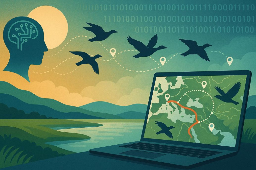
AI Maps Bird Migration for Conservation signals a turning point in how scientists and conservationists study bird movements to protect fragile ecosystems. With machine learning models crunching millions of radar and weather data points, researchers can now monitor birds with precision previously thought impossible. At the heart of this innovation lies the Atlantic Flyway, one of the busiest migratory bird corridors in the world. This technology is helping not just ornithologists but policymakers and citizens make data-driven decisions in the face of climate change. The fusion of AI and radar offers non-invasive, scalable insights into global biodiversity, shaping the future of environmental stewardship.
Key Takeaways
- AI-powered tools are revolutionizing the tracking of migratory birds across major corridors like the Atlantic Flyway.
- Weather radar, machine learning, and ecological datasets are combined to generate near-real-time maps of bird movements.
- These insights enable targeted conservation efforts and climate adaptation strategies.
- The project is a collaborative venture involving academia, NGOs, and government agencies, enhancing scientific impact and public engagement.
How Artificial Intelligence is Reshaping Bird Migration Research
Monitoring bird migration used to rely on labor-intensive banding, field surveys, and direct visual observations. Today, artificial intelligence is transforming that process. By pairing decades of Doppler radar data with ecological models, researchers can identify the density, speed, altitude, and direction of migrating birds at regional to continental scales. These models have been trained to distinguish between birds and other airborne entities like bats or rain droplets.
One of the leading initiatives in this space is the BirdCast Project, led by the Cornell Lab of Ornithology. Their AI system processes radar data from over 140 sites across the United States to forecast bird movements during peak migration seasons. This data is accessible to scientists and the general public through interactive live maps showing migration intensity across nights in spring and fall seasons.
The Science Behind the Systems: Radar and AI Integration
Weather surveillance radar, originally designed for meteorology, is now an indispensable tool in ornithology. Each radar station sweeps a 360-degree field, capturing reflective signatures in the atmosphere. Birds appear as distinguishable patterns based on how they reflect the radar beam relative to non-biological particles. Raw data alone cannot deliver the necessary clarity.
This is where machine learning models come into play. Algorithms trained on labeled historical radar returns enable AI systems to discern bird signatures from those of weather events or insects. These models are validated using ground-truth data collected through acoustic monitoring, field cameras, and citizen observations.
According to Dr. Andrew Farnsworth, a senior researcher at Cornell’s Lab of Ornithology, “We’ve gone from basic visualization of birds aloft to real-time migration forecasts thanks to AI’s capacity to parse massive datasets with astonishing granularity.”
From Data to Conservation: Mapping Actionable Insights
A key outcome of using AI in this context is the ability to translate data into conservation strategies. Understanding where and when birds pass through can inform window-lighting policies in urban areas, guide placement of wind turbines away from migratory pathways, and help preserve critical stopover habitats.
During the spring of 2022, BirdCast’s real-time alerts prompted New York City to dim skyline lights for several consecutive nights, significantly reducing bird collisions. Pilot programs are expanding to cities like Chicago and Dallas, where urban light pollution overlaps with high-volume migratory routes.
The ability to identify migration density also allows nonprofits and land managers to time prescribed burns, habitat restoration, and pesticide application windows to coincide with periods of low avian activity. This reduces human-wildlife conflict while maximizing ecological recovery. In addition, expanded use of artificial intelligence and climate change tools is becoming increasingly relevant in shaping regional conservation efforts.
Cross-Species Connections: Comparing Bird and Marine Tracking
Bird migration studies are not the only area benefiting from AI-driven analysis. Similar techniques are being applied to marine life. AI models trained on satellite telemetry have been used to map the movements of humpback whales and sea turtles within ocean corridors, often referred to as blue highways.
While radar tracks birds, marine tracking relies more heavily on GPS-tagged data collected via biologging devices. These systems identify recurring migratory routes, predict breeding grounds, and monitor disturbances caused by shipping lanes or climate shifts. What connects these efforts is AI’s ability to process spatiotemporal data at scale. This enables researchers to uncover hidden behavioral patterns across species and foster opportunities where animals interact with AI to support broader ecological insights.
Challenges and Ethical Considerations
Despite its promise, AI bird migration tracking is not without limitations. One technical challenge is model generalization. Systems trained on radar in the southeastern United States may not perform as accurately in the Pacific Northwest due to different bird populations and environmental conditions. Researchers are working on regional calibration to increase accuracy.
There are also ethical concerns. Large-scale data collection poses privacy questions for local communities and risks overdependence on automated systems. Balancing the speed of AI with the judgment of field ecologists remains vital.
The shift to real-time operational data introduces potential risks. If these systems are made open-source without safeguards, the information could potentially lead to exploitation of vulnerable species by poachers or unregulated land developers. In response, some initiatives are incorporating AI applications to combat poaching efforts while ensuring ethical standards are maintained.
Community Applications and Citizen Science Engagement
One of the most inspiring aspects of AI bird migration research is its accessibility to the public. Platforms like BirdCast feature interactive maps that allow birders, students, and educators to view nightly migration forecasts. These tools facilitate deep public engagement with local wildlife.
Apps such as eBird, also developed by the Cornell Lab, let users log sightings that feed into the same AI systems used for data training and validation. Teachers use this real-time data in classrooms to teach students about ecosystem dynamics. At the same time, city planners use these insights to support decisions involving lighting ordinances and green space developments.
Dr. Cecilia Nilsson, an ornithologist involved in AI-based migration models, notes, “Open-access data is critical. The more the public participates, the stronger both our models and our conservation outcomes become.” Many of these collaborative efforts align with broader goals in AI in environmental management and sustainability.
FAQ: Understanding AI’s Role in Bird Migration
How does AI help track bird migration?
AI integrates with weather radar to analyze movement patterns, density, altitude, and direction of birds in flight. Machine learning models are trained to distinguish bird signals from weather or insects. This produces accurate migration maps that inform conservation practices in near-real time.
What is the Atlantic Flyway?
The Atlantic Flyway is one of the four major North American bird migration corridors. It stretches from the Arctic tundra in Canada to the Caribbean and South America. This route serves as a critical pathway for hundreds of species during seasonal migrations.
Can weather radar detect birds?
Yes. Weather radar detects birds based on their reflectivity. Birds appear on radar as distinct patterns from meteorological elements. AI enhances this process by distinguishing and classifying these radar echoes using machine learning models trained with ecological data.
Why is bird migration important for conservation?
Migration provides vital information about biodiversity, habitat health, and climate change impacts. Protecting migratory birds supports pollination, pest control, and seed dispersion ecosystems. Tracking their movements helps policymakers safeguard habitats and reduce threats like light pollution or habitat fragmentation.
In the Field: A Researcher’s Perspective
Dr. Sydney Zhang, a field ecologist affiliated with the BirdCast Network, recalls a turning point moment. “In past years, we’d rely heavily on banding and unreliable seasonal estimates. Now, I can check overnight migration maps before a dawn patrol survey and know exactly where to focus our team’s efforts. It’s transformative.”
This blend of technology and field insight creates a layered, more accurate picture of avian behavior. As machine learning systems improve, ecologists anticipate even more precise species-level forecasting and impact analysis across entire ecosystems. This also helps elevate understanding of broader AI impacts on bird populations globally.
Conclusion: A Data-Driven Future for Conservation
The integration of AI in tracking bird migration signals a forward leap in both technology and biodiversity stewardship. By leveraging radar, machine learning, and community science, researchers not only understand where birds are flying, but also why, when, and under what environmental pressures. This depth of insight transforms conservation from reactive protection to predictive strategy.
Real time migration forecasting can reduce bird collisions with buildings and wind turbines. Climate linked pattern detection can guide habitat restoration before populations decline. Data integration across continents strengthens global cooperation for species that cross political borders without pause.
AI does not replace field biologists or community observers. It amplifies them. Human expertise remains essential in validating models, interpreting anomalies, and shaping ethical guardrails around wildlife data.
The future of conservation will depend on this partnership between intelligent systems and informed stewardship. With responsible implementation, AI can help move conservation from crisis response to anticipatory resilience.