Introduction: What is LiDar? How is it Used in Robotic Vision?
LiDAR is a rapidly evolving technology with many potential applications. It is also becoming increasingly affordable, which is opening up new opportunities for its use. LiDAR is capable of mapping the environment in 3D, this makes LiDAR a key component of larger technology set like robotics and autonomous vehicles.
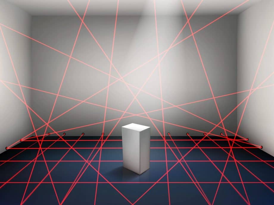
LiDAR stands for Light Detection And Ranging. It is a remote sensing technology that uses lasers to measure distance. LiDAR sensors emit short pulses of laser light and then measure the time it takes for the light to bounce back off of an object. This information can be used to calculate the distance between the sensor and the object. LiDAR sensors are often used in robotic vision systems because they are capable of measuring distance and detecting objects in 3D. This makes LiDAR ideal for applications, such as obstacle avoidance and navigation in dynamic environments.
LiDAR is capable of scanning the world in three dimensions and generating 3D models of everything from people to animals to plants. It may also be used to measure the size, form, and other characteristics of objects. LiDAR can also be used for motion detection and has a long list of potential applications.
Table of contents
- Introduction: What is LiDar? How is it Used in Robotic Vision?
- Understanding LiDAR: Principles and Technology Overview
- The Mechanics of LiDAR: From Laser Pulses to 3D Mapping
- Context on LiDAR Adoption
- How is LiDAR used in robotic vision?
- How Are Vision Systems and LiDAR Systems Used Together in Autonomous Vehicles?
- LiDAR for Aerial Robots: Improving Drone Navigation
- Industrial Applications of LiDAR in Robotics
- The Synergy between LiDAR and Other Sensing Technologies
- Possibilities for the Future
- Challenges and Limitations of Using LiDAR in Robotics
- The Impact of LiDAR on Robotics: From Precision to Safety
- Conclusion
- References
Understanding LiDAR: Principles and Technology Overview
LiDAR, an acronym for Light Detection and Ranging, is a remote sensing technology that uses light waves to capture and analyze the environment. This method employs a laser to emit light waves, which bounce off objects and return to the LiDAR sensor. By measuring the time taken for the light to travel to the object and back, LiDAR can accurately calculate distances, creating a detailed 3D model of the surrounding environment in real time. The technology has found a variety of applications across different industries and fields, including autonomous driving, airborne mapping, and atmospheric research. Various types of LiDAR systems, such as solid-state LiDAR, flash LiDAR, and continuous wave systems, have been developed to cater to specific needs.
Autonomous machines, like self-driving cars and mobile robots, utilize LiDAR technology extensively to navigate their environments safely and efficiently. The comprehensive 3D understanding provided by LiDAR sensors aids in object detection, avoidance, and path planning. Artificial intelligence algorithms can then process this rich stream of data to make informed decisions in real time. In the context of autonomous driving, this might involve detecting other vehicles, pedestrians, or road signs, and then deciding whether to speed up, slow down, or change direction. Similarly, in the case of autonomous robots, such as drones or ground-based robots, LiDAR data can be used to avoid obstacles and effectively navigate dense environments.
The Mechanics of LiDAR: From Laser Pulses to 3D Mapping
LiDAR technology operates on the principle of sending laser pulses towards a targeted area and measuring the time it takes for each pulse to bounce back to the sensor. The laser’s speed of light and the measured return time can compute the distance, which then creates a dense ‘point cloud’ of measurements. This is typically performed hundreds of thousands to millions of times per second, resulting in an extremely detailed 3D representation of the target area. These point clouds are then processed into what’s known as a Digital Elevation Model (DEM), which can represent ground elevation in various geospatial applications. Atmospheric LiDAR, a variant of this technology, uses the same principle but focuses on the scattering of light by the atmosphere to provide information about atmospheric properties like humidity, aerosol concentration, and wind speed.
In robotic and autonomous vehicle applications, LiDAR’s rapid and accurate 3D mapping plays a crucial role. For self-driving cars, this technology helps perceive the environment, identify objects, and predict potential changes in the surroundings, essentially serving as the ‘eyes’ of the car. Lidar sensors, particularly solid-state Lidar, have become the technology of choice for many electronic systems within these vehicles, owing to their durability, high performance, and decreasing cost. Various findings and advancements in LiDAR technology are often presented in platforms like the Geoscience and Remote Sensing Symposium, fostering a wide variety of applications beyond robotics and self-driving cars.
Context on LiDAR Adoption
The technology LiDAR is not new, it was invented in the 1960s. It has only recently become more widely used due to advances in sensor technology and computing power. One of the key reasons for this is that LiDAR data is very large in context, and early sensors could not generate enough data to be useful.
Recent advances have made LiDAR much more practical. For example, the Velodyne HDL-64E LiDAR sensor can generate up to 1.3 million points per second. This is a significant increase from earlier generations of LiDAR sensors, which could only generate around 10,000 points per second.
The increase in data rate is important because it allows LiDAR to be used for a variety of new applications. For example, LiDAR can now be used for object detection and tracking in autonomous vehicles. This is significant because autonomous vehicles need to be able to detect and avoid common obstacles in order to function safely.
Also Read: Blind robot that can run
How is LiDAR used in robotic vision?
LiDAR sensors are often used in robotic vision systems because they are capable of measuring distance and detecting objects in 3D. This makes LiDAR ideal for applications, such as obstacle avoidance and navigation in dynamic environments.
It is an amazing robotic solution for deep learning, as it can provide the 3D models needed for training data sets. LiDAR is also often used in conjunction with other sensor technologies, such as overlapping cameras and inertial measurement units (IMUs). This allows for a more complete understanding of the world and increases accuracy.
It is easy to implement machine vision to machine learning with LiDAR data, as they can convert it into a 2D point cloud. Extracting features from 3D point clouds can be more challenging. This is an area of active research, and several different approaches to machine vision solutions are being developed.
Autonomous robots are becoming increasingly common, and LiDAR is playing a big role in this trend. Many autonomous mobile robots are equipped with LiDAR sensors to help them navigate their surroundings. This is especially important for robots that need to operate in dynamic environments such as warehouses or hospitals.
Also Read: AI In Robotics: an Assimilation For The Next Phase In Technology.
How Are Vision Systems and LiDAR Systems Used Together in Autonomous Vehicles?
LiDAR is also being used in the development of self-driving cars. This is because LiDAR can provide a clear view of the world, even in bad weather conditions. LiDAR can be used to create 3D models of the world around the car, which is essential for autonomous driving.
Autonomous vehicles rely on a combination of sensors to navigate the world. This typically includes a LiDAR system, as well as cameras and radar. The LiDAR system is responsible for generating a 3D map of the environment. This map is then used by the vehicle’s control system to plan a safe route and avoid obstacles.
The cameras are used to provide additional information about the cluttered environment, such as traffic signs and traffic lights. The radar is used to detect other vehicles and objects in the vicinity. It is important to note that each of these sensors has its strengths and weaknesses. For example, LiDAR is great for generating 3D maps but is not very good at detecting small objects.
LiDAR is a great approach to autonomous navigation, but it is not the only option. There are other sensor improvement technologies that can be used, such as sonar and GPS. LiDAR is often seen as the best option because it provides a more complete view of the world.
Also Read: AI and Autonomous Driving.
LiDAR for Aerial Robots: Improving Drone Navigation
Airborne LiDAR, a subcategory of LiDAR technology, has emerged as a crucial component in the development and advancement of autonomous aerial robots, or drones. These autonomous machines employ LiDAR for purposes ranging from mapping and navigation to object detection and avoidance. Specifically, airborne LiDAR uses a time-of-flight approach, wherein a laser beam is sent to the ground and its reflection is captured. The time difference between sending the beam and receiving the reflected signal is used to calculate distance, providing high-resolution, three-dimensional information about the terrain below.
The evolution of LiDAR has led to the development of solid-state LiDAR and flash LiDAR, both of which offer unique benefits in drone applications. Solid-state LiDAR, due to its lack of moving parts, is inherently durable and well-suited for use in drones that may experience a wide variety of atmospheric conditions. Flash LiDAR, on the other hand, captures an entire scene in a single laser flash, providing a continuous wave of data that can be vital in quick-moving drone applications. Advancements in terrestrial laser scanning, a type of LiDAR technology, have also improved drone’s abilities in identifying objects and potential hazards on the ground. These advances, among others, have expanded LiDAR’s applications beyond conventional mapping and into areas like military applications, where drones are used for tasks such as surveillance or target identification.
Industrial Applications of LiDAR in Robotics
LiDAR technology has become an integral part of the Industrial Revolution 4.0, finding substantial use in various robotic applications within the industrial sector. Robots equipped with LiDAR sensors can navigate autonomously within factories and warehouses, avoiding obstacles and safely interacting with humans and other robots. For instance, LiDAR is used in autonomous guided vehicles (AGVs) and autonomous mobile robots (AMRs) to ensure accurate navigation and collision avoidance. These robotic systems are often employed in material handling, transportation, and inventory management roles within logistics and manufacturing operations.
Beyond navigation, LiDAR is instrumental in industrial inspection and monitoring tasks. Robots equipped with LiDAR can perform 3D scanning of structures, components, and products, generating highly detailed, accurate point cloud data that can be used for quality control, preventive maintenance, and other inspection applications. For instance, in the energy industry, LiDAR-equipped drones are used to inspect power lines, wind turbines, and solar panels, identifying potential faults or damage that might otherwise go unnoticed. Similarly, in the construction industry, LiDAR assists in creating 3D models of ongoing projects, helping to track progress and ensure that construction is proceeding as planned. Through these varied applications, LiDAR is enabling new levels of efficiency, safety, and productivity in the industrial sector.
The Synergy between LiDAR and Other Sensing Technologies
LiDAR technology doesn’t operate in isolation when deployed in many applications, especially in autonomous vehicles and aerial drones. Instead, it often works synergistically with other sensing technologies to provide a comprehensive understanding of the environment. For instance, the combination of LiDAR with radar can provide robustness under various atmospheric conditions. While radar excels in poor visibility conditions such as fog or heavy rain, LiDAR provides high-resolution 3D mapping capabilities, and together, they deliver a more consistent and reliable detection capability.
Combining LiDAR with cameras can greatly enhance the perception capabilities of robotic systems. Cameras can offer rich color information which is not available from LiDAR. By fusing the high-resolution depth maps obtained from LiDAR with camera imagery, robots can identify and classify objects more accurately. For example, in the context of autonomous driving, this synergy can enable the detection of road features and traffic flow with greater precision. Similarly, the fusion of LiDAR with other types of remote sensing data, such as aerial or satellite imagery, can create Digital Elevation Models with unparalleled accuracy, aiding applications from city planning to military operations. The future of robotic vision is likely to involve an even greater integration of different sensing technologies, leveraging the strengths of each to overcome their individual limitations.
Possibilities for the Future
LiDAR is a rapidly evolving technology with many potential applications. It is also becoming increasingly affordable, which is opening up new opportunities for its use.
In the future, we may see LiDAR being used in a wide range of approaches and industries, including construction, logistics, and even medicine. As LiDAR technology becomes more affordable, we will likely see it being used in more consumer products, such as smartphones and drones.
Apple has also added a LiDAR sensor to the iPhone, which allows for better-augmented reality experiences. It also helps capture better images and videos. Another unique application is that LiDAR is being used for security to detect intruders in large facilities or parking lots. These are just a few examples of the many possibilities for the future of automation using LiDAR.
Some of the potential applications for LiDAR include:
- Monitoring environmental conditions
- Re-mapping terrain
- Surveying land
- Navigating autonomously
- Capturing better images
- Improving augmented reality experiences
There are many other robotics applications for LiDAR, and it is likely that we will see even more in the future. LiDAR has proven to be a versatile and powerful technology with a bright future. Thanks to its many groundbreaking advancements and advantages, it is likely that we will see it being used in a variety of new and exciting ways in the years to come.
Challenges and Limitations of Using LiDAR in Robotics
While LiDAR is an incredibly powerful technology for robotic vision and 3D mapping, it does come with its own set of challenges and limitations. One of the primary limitations of LiDAR is its susceptibility to environmental conditions. For instance, adverse weather conditions such as heavy rain, fog, or snow can significantly degrade the performance of LiDAR systems, as they may scatter or absorb the emitted light pulses. Similarly, highly reflective or extremely dark surfaces can also distort LiDAR readings, causing errors in depth perception or even creating phantom obstacles.
Another significant challenge with LiDAR technology in robotics is its relatively high cost, especially compared to other vision and sensing technologies like cameras or radar. The cost factor has been a major barrier to the widespread adoption of LiDAR in cost-sensitive applications. The complexity of processing and interpreting LiDAR data, especially in real-time applications, can place high demands on the computational resources of a robotic system. This can lead to challenges in power management and system design. Despite these challenges, continuous advancements in LiDAR technology, such as the development of solid-state LiDAR systems, are helping to address these issues, making it increasingly feasible for a broader range of robotic applications.
The Impact of LiDAR on Robotics: From Precision to Safety
LiDAR technology has profoundly influenced the field of robotics, most notably by enhancing the precision and safety of robotic systems. A key advantage of LiDAR is its ability to create highly detailed 3D maps of the environment in real-time. In an autonomous robot, such as a self-driving car or drone, this detailed mapping is critical for accurate navigation and path planning. The system can precisely determine its relative position within the environment and make accurate predictions about the movement of objects in its surroundings, thereby improving its decision-making and navigation capabilities.
This precision carries a direct impact on safety, a crucial aspect in any robotic application involving interaction with humans or operating in complex, dynamic environments. The high-resolution data from LiDAR can be used to detect obstacles or hazards in the robot’s path, allowing for rapid, informed responses to avoid collisions. In the case of autonomous vehicles, for instance, LiDAR helps in detecting pedestrians, other vehicles, and infrastructure, enabling the vehicle to take appropriate actions to ensure the safety of its passengers and other road users.
The reliability of LiDAR, which performs well in a wide range of lighting conditions and weather situations, contributes significantly to the overall safety of robotic systems. Unlike cameras, LiDAR is not significantly affected by changes in lighting, such as transitions from day to night or direct sunlight interference. Its performance in various weather conditions, including rain or fog, though with some degradation, remains relatively robust, allowing for reliable operation of robots in different scenarios. In essence, LiDAR has become a cornerstone technology for many robotic systems, playing an instrumental role in enhancing their precision, safety, and overall performance.
Conclusion
LiDAR technology serves as a key enabling technology for modern robotics, playing a crucial role in creating highly detailed three-dimensional maps for robust navigation, enhancing the safety and precision of various robotic systems. It has established its significance in a wide range of applications, from autonomous vehicles to aerial drones and industrial robotics. The high-resolution and reliable data it provides, regardless of lighting or weather conditions, have made it an integral part of many advanced robotic vision systems.
Looking ahead, while LiDAR technology continues to mature, its synergy with other sensing technologies will likely play an increasingly important role in the future of robotics. The fusion of data from LiDAR, cameras, radar, and other sensors could yield even more robust perception capabilities, paving the way for more sophisticated, adaptable, and resilient robotic systems. While challenges persist, such as cost and the requirement for high computational resources, advancements in solid-state LiDAR technology and edge computing solutions are promising steps towards overcoming these obstacles. The journey of LiDAR, from its origins in atmospheric research to its pivotal role in robotic vision, exemplifies the transformative power of technology, and there is much to look forward to as its applications continue to evolve and expand.

References
Beyerer, Jürgen, et al. Machine Vision: Automated Visual Inspection: Theory, Practice and Applications. Springer, 2015.
Chen, Ziyue. The Application of Airborne Lidar Data in the Modelling of 3D Urban Landscape Ecology. Cambridge Scholars Publishing, 2016.
McManamon, Paul F. LiDAR Technologies and Systems. SPIE-International Society for Optical Engineering, 2019.
Sergiyenko, Oleg, et al. Machine Vision and Navigation. Springer Nature, 2019.
Weitkamp, Claus. Lidar: Range-Resolved Optical Remote Sensing of the Atmosphere. Springer Science & Business, 2006.