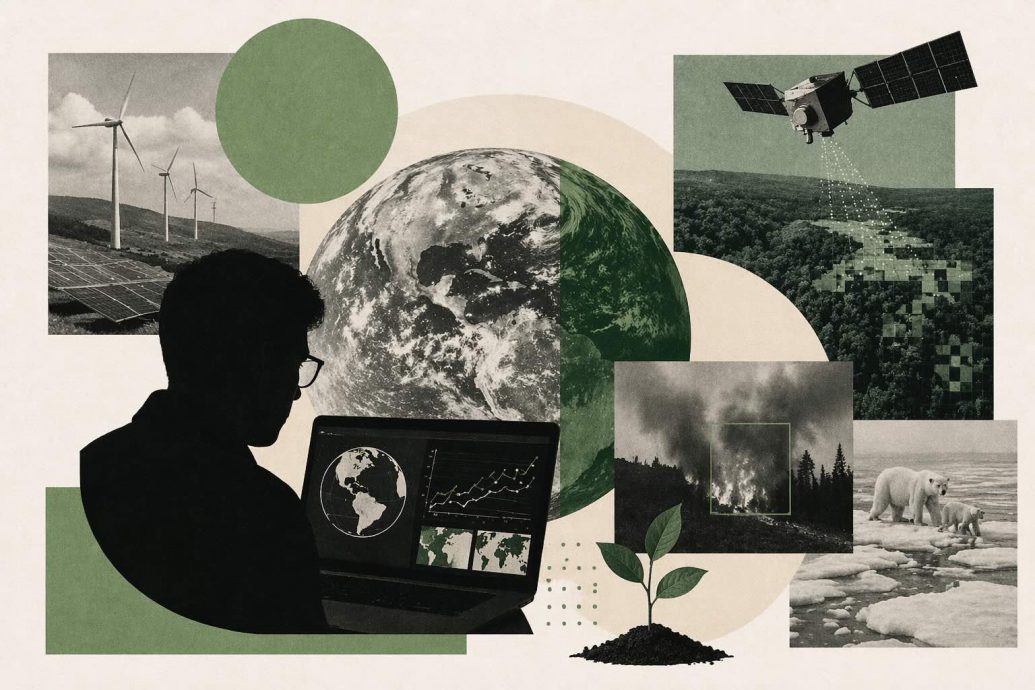
Introduction
Robert Downey Jr. opens the seventh episode standing inside a rainforest canopy, wearing headphones connected to an AI-powered acoustic monitor. The camera pans across dense trees while an algorithm classifies bird calls, chainsaw sounds, and insect patterns in real time. A 2023 study in Nature estimates that machine learning could help monitor up to 80 percent of terrestrial biodiversity through acoustic and satellite sensing combined. That ambition drives every project featured in this documentary hour, from deforestation alerts to disaster prediction networks worldwide. The filmmakers balance scientific detail with emotional storytelling, letting field researchers speak alongside data engineers across locations. Viewers see algorithms working inside muddy boots and satellite ground stations rather than polished Silicon Valley conference rooms. This guide unpacks every claim, character, and technical system the episode puts in front of its audience.
Key Questions
What is The Age of A.I. Season 1 Episode 7 about?
The Age of A.I. Season 1 Episode 7, titled Saving the World One Algorithm at a Time, profiles AI projects tackling deforestation, wildlife tracking, disaster prediction, precision agriculture, and climate modeling across multiple continents.
Which AI-for-good projects does the episode feature?
The episode features acoustic wildlife monitoring, satellite deforestation alerts, natural disaster prediction systems, precision agriculture platforms, and ocean sensor networks, each using machine learning for environmental outcomes.
How do algorithms help save the environment according to the documentary?
Algorithms process satellite imagery, acoustic recordings, sensor data, and climate models at speeds humans cannot match, enabling faster deforestation detection, species tracking, disaster warnings, and farm optimization worldwide.
Key Takeaways
- Acoustic AI monitors classify endangered species calls, illegal logging sounds, and ecosystem health signals across remote forests without human presence.
- Satellite-based machine learning detects deforestation patches within days rather than the months traditional ground surveys typically require.
- Precision agriculture algorithms optimize water, fertilizer, and pest management to reduce waste while feeding growing global populations.
- The episode warns that AI-for-good depends on sustained funding, open data, and ethical governance that currently remain inconsistent across projects.
Table of contents
- Introduction
- Key Questions
- Key Takeaways
- Definition
- The Episode That Made Algorithms Feel Like Heroes
- How Robert Downey Jr. Reframed Tech Optimism on Camera
- Wildlife Tracking When Ears Replace Eyes
- Satellite Eyes Over Disappearing Forests
- Predicting Natural Disasters Before They Strike
- Feeding Nine Billion People With Smarter Farms
- The Deep Learning Stack Behind Environmental Monitoring
- When Conservation Tech Becomes Surveillance Infrastructure
- Climate Modeling at a Scale Humans Cannot Process Alone
- Grassroots Teams Wielding Corporate AI Tools
- Whose Data Powers the Algorithm That Saves You
- Ocean Health and the Sensors Below the Surface
- Real Case Studies From the Frontlines of AI for Good
- The Funding Problem Nobody Wants to Discuss
- Ethical Boundaries in Algorithmic Environmentalism
- Lessons Other Industries Are Pulling From Conservation AI
- What Comes After the First Generation of Planet-Scale Models
- Why This Episode Lingers Longer Than the Others
- Key Insights
- Real-World Examples
- Case Studies
- FAQs
Definition
AI for good is the application of artificial intelligence tools, including machine learning, computer vision, and predictive analytics, to environmental, humanitarian, and public health challenges, aiming for measurable positive outcomes beyond commercial profit.
The Episode That Made Algorithms Feel Like Heroes
Episode seven opens differently from previous installments, replacing studio interviews with field footage from tropical forests and drought-stricken farmland. Robert Downey Jr. narrates over scenes of researchers deploying acoustic sensors, calibrating satellite feeds, and training models on laptops in remote research stations. The shift from urban labs to wild settings signals that this episode cares more about outcomes than about the technology itself. Producers let the landscapes carry emotional weight, trusting viewers to connect the algorithm to the animals, trees, and communities it serves. The pacing feels slower and more deliberate, rewarding audiences willing to sit with complexity rather than demanding quick spectacle.
What distinguishes this installment is the quiet insistence that algorithms earn their hero status through measurable environmental results. Producers avoid the common trap of treating AI as inherently beneficial simply because it processes large datasets at impressive speeds. Each featured project faces honest scrutiny about accuracy, funding stability, and the human expertise required to make software useful. That editorial discipline strengthens the documentary’s credibility and sets it apart from corporate sustainability marketing videos online. Readers interested in broader context can explore ongoing AI and climate change applications across the web.
How Robert Downey Jr. Reframed Tech Optimism on Camera
Robert Downey Jr. enters the episode as a self-described tech enthusiast, openly curious about whether algorithms genuinely deliver on environmental promises. His questions avoid softball setups, pressing researchers on failure rates, data gaps, and the risk of overpromising to funders. Producers capture moments where his enthusiasm meets honest pushback from field scientists who describe years of slow, incremental progress. This dynamic prevents the episode from sliding into celebrity endorsement territory, grounding the narrative in working science. The host’s willingness to look uncertain on camera builds trust with skeptical viewers who distrust uncritical tech journalism.
His most memorable moment comes during a quiet exchange with a conservation biologist who explains how her algorithm missed an endangered frog species for two years. The biologist describes retraining the model after discovering a labeling error that excluded juvenile call patterns from the training dataset entirely. Downey listens without interrupting, then asks how many other species might be hiding inside similar blind spots across other monitoring projects. That question captures the episode’s broader thesis about algorithmic humility, the idea that even helpful AI carries risks that only honest scrutiny reveals. Producers let the scene run long, trusting that curiosity matters more than pace for this audience.
Wildlife Tracking When Ears Replace Eyes
Acoustic monitoring represents one of the episode’s most vivid applications, with microphones replacing camera traps across dense tropical canopies. Researchers deploy solar-powered recording units that capture thousands of hours of audio across remote forest sites continuously. Machine learning classifiers then sort these recordings into species calls, anthropogenic sounds like chainsaws, and environmental noise like rain and wind. The result is a real-time biodiversity dashboard that field teams can access from base camps or urban offices hundreds of kilometers away. This approach scales dramatically cheaper than traditional visual surveys requiring trained observers physically present in each habitat.
The episode profiles Rainforest Connection, an organization that repurposes old smartphones as acoustic sentinels hanging from forest canopy branches worldwide. Their platform, called RFCx, uses convolutional neural networks to detect illegal logging, poaching activity, and species presence simultaneously. Producers show the messy reality of hardware deployment, including failed batteries, water damage, and connectivity drops across mountainous terrain. These unglamorous details remind viewers that AI-for-good projects depend on robust fieldwork, not just elegant code running on reliable servers. Coverage of related approaches appears in pieces about AI and bird population monitoring for readers curious about acoustic ecology.
The most striking claim is that a single acoustic sensor can monitor biodiversity across an area that would require dozens of human observers working simultaneously. Researchers caution that acoustic coverage works best for vocal species, leaving silent creatures like reptiles, insects, and nocturnal mammals underrepresented in the data. Model accuracy also depends heavily on training data quality, which remains thin for many endangered species with few recorded vocalizations globally. These limitations do not invalidate the approach but they frame it as a complement to, rather than replacement for, traditional field ecology. The episode handles this nuance carefully, avoiding the temptation to present any single technology as a conservation silver bullet.
Satellite Eyes Over Disappearing Forests
A transition from acoustic monitoring to orbital sensing widens the scale of intervention from individual trees to entire continental forest systems. Satellite platforms like Landsat, Sentinel, and Planet Labs deliver imagery that machine learning systems process into deforestation alerts within days of canopy loss. Organizations like Global Forest Watch, run by the World Resources Institute, make these alerts publicly accessible through interactive dashboards online. Enforcement teams in Brazil, Indonesia, and the Congo Basin use these alerts to direct limited ranger resources toward active deforestation fronts more efficiently. Alert data and methodology details appear on the Global Forest Watch platform for readers tracking near-real-time forest loss.
Deep learning classifiers distinguish between natural forest loss from storms and fires versus anthropogenic clearing for agriculture, mining, or logging operations. This distinction matters enormously for enforcement agencies, since natural events require different responses than illegal land conversion activities. Training data for these classifiers comes from verified ground surveys, expert annotation, and historical clearing patterns across multiple biomes worldwide. Accuracy has improved steadily across the last decade, though cloud cover, seasonal variation, and sensor resolution still introduce errors in critical regions. Researchers interviewed acknowledge that no satellite system replaces ground truth, but the technology dramatically accelerates the detection-to-response timeline.
What makes satellite-based deforestation monitoring genuinely transformative is the shift from retrospective reporting to near-real-time intervention against illegal clearing. Before these systems, governments often discovered forest loss months or years after the damage occurred, making enforcement practically impossible. Today, some jurisdictions receive alerts within 48 hours, enabling rapid deployment of rangers, drones, or legal teams to active clearing sites. Producers capture a Brazilian enforcement officer receiving an alert on her phone during filming, then organizing a field response within hours. That scene condenses years of technological development into a single powerful moment that viewers remember long after the credits roll.
Predicting Natural Disasters Before They Strike
A transition from forests to disaster zones shows how algorithms now contribute to early warning systems for floods, earthquakes, wildfires, and hurricanes worldwide. Machine learning models ingest meteorological data, soil moisture readings, historical event patterns, and satellite imagery to generate probabilistic forecasts ahead of events. Google’s flood forecasting initiative, profiled briefly, provides alerts to communities across South Asia and parts of Africa before major flood events occur. These systems complement rather than replace traditional meteorological services, adding granularity and lead time to existing warning infrastructure. Readers tracking this space can review improving weather forecasting with AI for technical updates.
The episode makes clear that prediction alone does not save lives unless communities trust, receive, and act on algorithmic warnings in time. Producers interview a disaster response coordinator who describes communities ignoring accurate flood warnings because previous false alarms eroded public confidence. Last-mile communication, cultural context, and institutional trust shape whether a prediction becomes a life-saving intervention or just another ignored alert. Engineers interviewed acknowledge that building trust requires years of consistent accuracy and community engagement beyond the algorithm itself. This human dimension separates genuinely effective AI disaster systems from technically impressive but practically unused research prototypes.
Feeding Nine Billion People With Smarter Farms
A transition from disaster prediction to food security connects algorithmic intervention to the daily survival of billions of people across developing economies. Precision agriculture uses satellite imagery, soil sensors, drone surveys, and weather models to optimize planting, irrigation, fertilization, and harvest timing across farms. Small-scale farmers in sub-Saharan Africa and South Asia increasingly access AI-driven advisories through mobile phone applications delivering localized recommendations. These tools can reduce water waste, minimize fertilizer runoff, and improve yields without requiring expensive equipment purchases or radical changes. Coverage of related technology appears in pieces about sustainable farming practices with AI for interested readers.
Producers visit a Kenyan farming cooperative where members describe receiving planting advice via SMS generated by a machine learning platform processing regional weather data. The cooperative reports measurably higher yields after two seasons of following algorithmic recommendations compared with traditional timing practices alone. Skeptics caution that such gains depend heavily on consistent data coverage, reliable connectivity, and ongoing model calibration for local soil types. These dependencies make scaling precision agriculture across diverse geographies much harder than pilot results might initially suggest to funders. The episode treats this complexity honestly, avoiding the trap of extrapolating one cooperative’s success into a universal solution.
What makes precision agriculture urgent is the arithmetic of feeding nearly ten billion people by 2050 on a warming, water-stressed planet. Current agricultural systems waste roughly one-third of all food produced globally, according to the Food and Agriculture Organization of the United Nations. Algorithms that reduce waste at the farm level compound their impact across supply chains, storage, and distribution networks downstream of production. AI cannot solve food insecurity alone, since political access, trade policy, and income inequality shape hunger outcomes more than yield numbers do. The documentary acknowledges these structural constraints, positioning algorithms as powerful tools within a larger system rather than standalone saviors.
The Deep Learning Stack Behind Environmental Monitoring
A transition from application stories to technical architecture explains how the models actually work inside the systems the episode profiles. Convolutional neural networks process satellite imagery by scanning image patches for learned features like canopy texture, road patterns, and water boundaries. Recurrent neural networks and transformers handle time-series data, including acoustic recordings, weather sequences, and soil moisture trends. Transfer learning allows teams to adapt models trained on abundant data, like ImageNet, to niche environmental tasks with limited labeled samples. This technical versatility explains why small conservation teams can build capable systems without the massive datasets or budgets that major technology companies command.
Cloud computing platforms, primarily Google Earth Engine, Microsoft Planetary Computer, and Amazon Web Services, provide the processing infrastructure that most conservation teams rely on. These platforms offer free or subsidized compute to qualified researchers, lowering the cost barrier that once limited satellite analysis to well-funded government agencies. Producers show a three-person team in Indonesia running deforestation classifiers on Google Earth Engine using only laptops and a shared internet connection. That accessibility represents a genuine democratization of environmental intelligence, though it also creates dependency on corporate platforms whose priorities may shift. Readers wanting deeper technical grounding can explore what deep learning actually is for foundational context.
The episode’s most technically revealing moment comes when an engineer explains that model accuracy often depends more on training data quality than on architectural complexity. A simpler model trained on carefully labeled, representative data frequently outperforms a complex architecture trained on noisy, biased samples across environmental tasks. This insight challenges the popular narrative that bigger models always produce better results, redirecting attention toward data curation and field expertise. Conservation teams that invest heavily in annotation quality report fewer false alarms and higher trust from enforcement partners relying on their outputs. Producers capture a labeling session where biologists and data scientists debate edge cases, illustrating the irreducibly human judgment inside every environmental model.
When Conservation Tech Becomes Surveillance Infrastructure
A transition from technical architecture to ethical territory surfaces one of the episode’s most uncomfortable threads about dual-use technology. Acoustic sensors designed to detect illegal logging also capture human conversations, movements, and activity patterns across monitored landscapes. Satellite systems built for deforestation alerts can track indigenous communities, illegal miners, and small-scale farmers with equal precision and capability. Camera trap networks intended for wildlife monitoring increasingly overlap with law enforcement surveillance operations in protected areas globally. These overlaps raise serious privacy, consent, and governance questions that most conservation organizations have only begun to address openly.
Indigenous communities in particular face heightened surveillance risks, since their traditional territories often overlap with high-biodiversity conservation zones under constant monitoring. Some communities welcome technology that protects their forests, while others view external monitoring as an extension of colonial land management practices imposed from outside. Consent frameworks vary enormously across projects, ranging from genuine co-design to minimal notification before sensor deployment across community territories. Producers interview a community leader who describes negotiating data access rights with a conservation NGO reluctant to share algorithmic outputs with local representatives. That negotiation highlights power imbalances that technical solutions alone cannot resolve without deliberate governance reforms.
The episode warns that conservation technology without community consent risks reproducing the very extraction patterns it claims to prevent. Researchers quoted describe cases where monitoring data reached law enforcement agencies without community knowledge, leading to evictions rather than conservation outcomes. These failures erode trust, making future conservation partnerships harder to establish in regions where communities feel betrayed by previous programs. Some organizations now adopt data sovereignty frameworks that give communities ownership over information collected on their lands and territories. The documentary supports this direction without prescribing a universal model, acknowledging that governance must adapt to local legal, cultural, and political contexts.
Climate Modeling at a Scale Humans Cannot Process Alone
A transition from surveillance ethics to planetary-scale computation shows how algorithms now contribute to climate science in ways traditional methods cannot match. General circulation models divide the Earth’s atmosphere and oceans into grid cells, simulating physical processes across millions of interconnected data points simultaneously. Machine learning increasingly accelerates these simulations by emulating expensive physics calculations, enabling faster scenario testing across decades of projected conditions. Google DeepMind’s GraphCast model demonstrated weather prediction accuracy matching leading numerical models at a fraction of computational cost per forecast. Published details and evaluation appear on the Google DeepMind GraphCast research page for researchers.
Traditional climate models require supercomputer clusters that cost millions to operate, limiting access to well-funded national agencies and university consortia. AI emulators promise to democratize climate projection by allowing smaller institutions, developing nations, and regional planners to run scenarios on modest hardware. Producers interview a climate scientist who describes running localized flood projections for a Pacific island nation using a laptop-based emulator for the first time. That scene captures a genuine shift in who gets to participate in climate adaptation planning, previously restricted to wealthy institutions. Coverage of related developments appears in pieces about AI in climate and environmental management online.
Emulation does not replace physics-based climate models but rather extends their reach to communities and decision-makers previously excluded from serious planning. Researchers caution that emulators inherit biases from the models they approximate, including grid resolution limits, parameterization choices, and historical data gaps. Users must understand these limitations to avoid overconfident decisions based on outputs that carry embedded uncertainty at every step. The episode features a frank discussion where two climate scientists disagree about how transparent emulator limitations should be in public-facing dashboards. That disagreement models the kind of productive scientific tension the documentary consistently prefers over artificial consensus.
Policy makers increasingly demand localized climate projections that global models struggle to deliver at municipal or district resolution across diverse geographies. Downscaling techniques, enhanced by machine learning, attempt to bridge this gap by translating coarse global outputs into finer regional predictions. These downscaled projections inform infrastructure investment, agricultural planning, and insurance pricing across vulnerable regions worldwide. Accuracy varies significantly by region, with data-rich areas like North America and Europe outperforming data-sparse regions across Africa and the Pacific. Producers note this disparity carefully, connecting it to broader inequities in who benefits from AI-powered climate science.
Grassroots Teams Wielding Corporate AI Tools
A transition from planetary models to local implementation shows how small conservation teams access tools built by technology giants for free or nominal cost. Google Earth Engine, Microsoft AI for Earth, and Amazon Sustainability Data Initiative provide cloud compute, pre-trained models, and curated datasets. Field teams in Madagascar, Colombia, and Borneo use these platforms to monitor deforestation, track species, and forecast crop conditions locally. Producers capture the practical reality of a two-person team in Colombia building a functional deforestation dashboard over a weekend using free cloud tools. That speed was unimaginable a decade ago, when similar analysis required months of satellite procurement, manual processing, and expensive software.
The tradeoff is dependency, since grassroots teams build critical infrastructure on platforms controlled by corporations whose priorities can shift overnight. Google discontinued its AI for Social Good grant program in previous years, leaving some teams scrambling for alternative compute access quickly. Microsoft and Amazon have maintained their environmental programs longer, though terms of service and data policies remain subject to unilateral change. Producers interview a conservation director who describes maintaining offline backups and open-source alternatives as insurance against platform withdrawal. This pragmatic resilience reflects lessons learned across the nonprofit technology sector over the past decade of corporate philanthropy cycles.
Whose Data Powers the Algorithm That Saves You
A transition from platform dependency to data governance raises fundamental questions about who owns, controls, and benefits from environmental datasets. Satellite imagery often comes from government agencies like NASA and ESA, but processing pipelines sit inside private cloud platforms with proprietary terms. Acoustic data collected in community forests may travel to servers in distant countries where local stakeholders cannot audit, correct, or delete records. Biodiversity databases like GBIF aggregate millions of species observations, yet contributing researchers rarely control how their data gets reused commercially. These ownership gaps create risks that range from scientific misattribution to corporate exploitation of publicly funded environmental knowledge.
Open data principles exist but enforcement remains voluntary, leaving most environmental AI systems operating inside a legal gray zone. Organizations like the Open Data Institute advocate for clear licensing, provenance tracking, and community benefit agreements attached to environmental datasets. Some projects now publish data under Creative Commons licenses, while others restrict access to protect sensitive species locations from poachers. Producers feature a database administrator who explains the impossible tension between openness for science and secrecy for species survival. That tension defines a governance challenge that the documentary frames as unsolved but urgently requiring coordinated international attention across institutions.
Ocean Health and the Sensors Below the Surface
A transition from terrestrial data to marine systems shows how algorithms increasingly monitor ocean health through underwater sensors and satellite proxies. Autonomous underwater vehicles, buoy networks, and acoustic arrays generate continuous streams of temperature, salinity, acidity, and biological data across ocean basins. Machine learning models process these streams to detect coral bleaching events, illegal fishing activity, and shifting migratory patterns for commercially important species. The Ocean Observatories Initiative and Argo float network provide publicly accessible ocean data described on the Ocean Observatories Initiative data portal for reference. Producers visit a monitoring station where marine biologists describe training classifiers to distinguish whale calls from ship noise inside crowded shipping lanes.
Illegal fishing detection represents one of the most impactful applications, with satellite-based vessel tracking systems identifying suspicious behavior at scale globally. Global Fishing Watch, a nonprofit partnership, uses machine learning to analyze vessel movement patterns and flag potential violations across national boundaries. Their platform provides public access to fishing activity data documented on the Global Fishing Watch map platform for transparency. Enforcement remains patchy, since many nations lack the naval resources to respond to algorithmic alerts across vast exclusive economic zones. Producers interview a fisheries enforcement officer who describes receiving hundreds of alerts monthly but being able to investigate fewer than ten.
The ocean remains the planet’s least monitored biome, with sensor coverage concentrated in wealthy northern hemisphere waters and leaving vast tropical and southern regions poorly observed. This geographic bias means AI models trained on available data perform best where monitoring is least needed, perpetuating existing inequities in environmental science. Expanding coverage requires international cooperation, sustained funding, and hardware deployments that withstand extreme pressure, corrosion, and biofouling. Some researchers experiment with low-cost sensor designs that developing nations can manufacture and deploy independently. The episode treats ocean monitoring as both an inspiring application and a cautionary reminder about the limits of algorithmic intervention.
Real Case Studies From the Frontlines of AI for Good
A transition from ocean monitoring to documented case studies grounds the episode in verified outcomes rather than aspirational claims. Rainforest Connection deployed acoustic monitoring across 35 countries by 2024, generating deforestation alerts and species occurrence data for conservation partners globally. Their Guardian sensor system has contributed to documented enforcement responses in multiple jurisdictions. Further platform details and partner documentation appear on the Rainforest Connection project page for readers seeking specifics. Limitations include dependency on cellular or satellite connectivity, hardware attrition in tropical conditions, and funding volatility across grant cycles.
Global Forest Watch, operated by the World Resources Institute, processes satellite imagery across all tropical forests and delivers near-real-time alerts through an open-access dashboard. The platform has been cited in enforcement actions, academic publications, and policy debates across dozens of countries since its launch. Measurable impact includes documented reductions in response time from months to days across jurisdictions that integrate alerts into enforcement workflows. Limitations include cloud cover gaps, resolution limits, and the dependence on ground enforcement capacity that varies enormously across regions. Platform methodology and real-time data appear on the Global Forest Watch dashboard for public access.
Microsoft AI for Earth awarded over $100 million in cloud computing resources and grants to conservation projects between 2017 and 2023. Supported projects range from precision agriculture in Kenya to coral reef monitoring in Australia to wildfire prediction across western North America. Measurable impact includes hundreds of published research papers, deployed monitoring systems, and policy-relevant datasets released by funded teams. Limitations include program scope changes, corporate priority shifts, and sustainability concerns for teams reliant on continued Microsoft support. Program documentation and grantee profiles appear on the Microsoft AI for Earth program page for review.
Looking across these cases, the pattern is clear: AI-for-good projects deliver measurable environmental value only when sustained funding, field expertise, and institutional partnerships hold together. Technology alone never suffices, and the most impactful projects combine algorithmic power with deep local knowledge, enforcement partnerships, and transparent reporting. Producers close this section by noting that many promising pilots fail to scale not because the technology breaks but because the funding or governance collapses. That observation carries sobering weight for anyone evaluating AI-for-good investments with expectations of rapid, permanent global impact. Deeper analysis of AI for disaster response and risk explores parallel dynamics in humanitarian sectors.
The Funding Problem Nobody Wants to Discuss
A transition from successful case studies to financial reality introduces the funding challenge that quietly threatens most AI-for-good projects worldwide. Grant cycles typically last two to three years, which rarely aligns with the decade-long timelines required to build, validate, and sustain environmental monitoring systems. Academic funding pressures reward novel model development over operational maintenance, leaving deployed systems without engineering support after publications appear. Corporate philanthropy programs fluctuate with quarterly earnings, executive priorities, and public relations strategies that change faster than ecosystems do. These structural mismatches between funding rhythms and ecological timescales define the most persistent challenge across the field.
Producers interview a project director who describes spending forty percent of her time fundraising instead of improving the system communities depend on daily. She explains that donors prefer funding new pilots over sustaining proven systems, creating a perverse incentive toward perpetual novelty at the expense of reliability. Teams that resist this pressure often lose grants to flashier competitors with better marketing materials and less operational track records. The documentary treats this funding dysfunction not as a footnote but as a central obstacle that determines which algorithms survive and which quietly disappear.
The most uncomfortable truth the episode surfaces is that some of the world’s most effective environmental AI systems operate one missed grant cycle from shutdown. Teams cannot retain talent, maintain hardware, or update models when budgets reset annually without guaranteed continuation across multi-year commitments. Some organizations have explored earned revenue models, charging governments or companies for premium data access while keeping basic alerts free. Others partner with insurance companies, agricultural lenders, or carbon credit platforms that value the predictive data these systems generate consistently. Producers present these financial experiments without endorsement, letting viewers judge whether commercial sustainability compromises or strengthens the public mission.
Ethical Boundaries in Algorithmic Environmentalism
A transition from funding to ethics broadens the conversation beyond financial sustainability toward deeper normative questions about power and agency. Who decides which species, forests, or communities receive algorithmic attention, and whose values shape the priorities embedded in training data? Conservation triage algorithms that rank species by extinction probability, genetic uniqueness, and ecosystem function codify subjective value judgments into mathematical weights. These weights reflect the priorities of the researchers and funders who design them, not necessarily the communities who live alongside the species in question. Producers capture a tense meeting where a conservation biologist questions whether algorithmic triage inadvertently devalues species important to indigenous food systems.
Data bias represents another ethical surface, with training datasets overrepresenting well-studied ecosystems in North America, Europe, and parts of Asia dramatically. Models trained on these datasets perform poorly in data-sparse regions where conservation needs are often most urgent and resources most scarce. Researchers describe efforts to balance datasets through active learning, community annotation, and targeted data collection campaigns across underrepresented biomes. These efforts help but cannot fully correct decades of uneven scientific investment that shaped the data landscape conservation AI now inherits.
The episode argues that algorithmic environmentalism must answer not just whether it works but for whom it works and who bears the costs. Communities displaced by protected area enforcement, farmers penalized by satellite-detected clearing on customary lands, and indigenous groups monitored without consent all bear costs that algorithms do not automatically account for. Ethical AI-for-good requires governance structures that distribute benefits and burdens fairly across affected populations. Some organizations now employ community advisory boards, ethical review panels, and benefit-sharing agreements modeled on clinical research consent frameworks. The documentary endorses this direction without claiming any single model has fully solved the governance challenge.
Lessons Other Industries Are Pulling From Conservation AI
A transition from ethics to cross-sector influence shows how conservation AI methods now inform applications across urban planning, insurance, and supply chain management. Cities use satellite-based vegetation indices originally developed for forest monitoring to track urban tree canopy health and heat island dynamics. Insurance companies apply wildfire prediction models to price property risk more accurately across fire-prone regions. Supply chain auditors use deforestation alerts to verify whether commodity suppliers comply with zero-deforestation pledges made to consumers. These cross-sector transfers demonstrate that conservation AI produces intellectual capital with value far beyond its original environmental domain.
The most consequential transfer may be the conservation sector’s hard-won lessons about data quality, community engagement, and long-term system maintenance. Technology companies launching AI-for-good initiatives increasingly consult conservation veterans who understand field deployment realities that laboratory prototypes never encounter. Those veterans emphasize that algorithms fail without trust, ground truth, and institutional partnerships sustaining them across years and political cycles. Coverage of related urban applications appears in pieces about smart cities built sustainably for readers interested in the spillover. Conservation AI’s influence on other sectors may ultimately matter more than its direct environmental impact alone.
What Comes After the First Generation of Planet-Scale Models
A transition from current applications to near-term futures invites measured speculation about where environmental AI is heading this decade. Foundation models trained on massive multi-modal datasets, combining satellite imagery, acoustic recordings, weather data, and text, promise more versatile environmental intelligence. These models could enable zero-shot classification, where a system identifies species or land cover types it was never explicitly trained on. Early prototypes from Microsoft, Google, and academic consortia show promising results, though validation across diverse ecosystems remains incomplete and ongoing. The earlier robots and jobs episode explored similar generalization ambitions in workplace automation contexts.
Digital twin ecosystems represent another frontier, where virtual replicas of forests, watersheds, or coral reefs simulate interventions before physical deployment occurs. These twins combine sensor data, historical records, and predictive models to let managers test policies, restoration plans, and climate scenarios virtually first. European Commission programs and several national environmental agencies have begun funding digital twin pilots for river basins and marine reserves. Producers caution that digital twins require enormous data inputs and continuous calibration, making them expensive and fragile without institutional commitment. Early results suggest that twins work best as decision support tools rather than autonomous management systems.
The next generation of environmental AI will likely integrate real-time sensor networks, foundation models, and citizen science platforms into unified monitoring systems. Citizen science contributions from mobile apps like iNaturalist, eBird, and Merlin already generate millions of observations that complement professional surveys. Machine learning validates, cleans, and integrates these contributions into scientific datasets at a scale no manual curation team could match. The combination of professional instruments, citizen observers, and adaptive algorithms creates a monitoring infrastructure that improves itself as participation grows. Readers interested in the following installment can explore the next episode searching for aliens in the series.
Why This Episode Lingers Longer Than the Others
A transition from futures to cultural reception closes the guide by reflecting on why this particular installment resonates beyond the tech-curious audience. Environmental anxiety cuts across demographics, which means the episode’s subject matter connects to viewers who might otherwise skip an AI documentary entirely. Parents, teachers, farmers, and policymakers see their own concerns reflected in the footage of burning forests and rising seas shown on screen. That broad relevance gives the episode staying power in classrooms, workshops, and community screenings long after its initial streaming release. Comment sections and social media discussions consistently cite episode seven as the installment that changed how they think about technology.
The lasting contribution may be normalizing the idea that algorithms belong in the field, not just in data centers, and that environmental work is technology work. Conservation organizations report increased interest from computer science students after the episode, citing it as a recruiting catalyst for interdisciplinary careers. That pipeline matters because the field needs engineers who understand ecology and ecologists who understand code working together consistently. If the documentary inspires even a modest fraction of its audience to pursue environmental data science, the talent pipeline strengthens meaningfully. The episode succeeds as both journalism and invitation, asking viewers not merely to watch but to participate in the work it describes.
Key Insights
- A 2023 Nature study estimates machine learning could help monitor up to 80 percent of terrestrial biodiversity per Nature’s coverage.
- Rainforest Connection has deployed acoustic monitors across 35 countries, generating real-time deforestation and species alerts per the Rainforest Connection project overview.
- Global Forest Watch processes satellite imagery across all tropical forests and delivers near-real-time deforestation alerts per the Global Forest Watch platform.
- Google DeepMind’s GraphCast achieved weather prediction accuracy matching leading numerical models at a fraction of the cost per the DeepMind GraphCast research page.
- Microsoft AI for Earth distributed over $100 million in cloud computing and grants to conservation projects per the Microsoft AI for Earth program page.
- The FAO estimates roughly one-third of all food produced globally is lost or wasted per the FAO food loss and waste page.
- Global Fishing Watch uses machine learning to track vessel movements and identify illegal fishing per the Global Fishing Watch platform.
- The Argo float network maintains over 4,000 autonomous ocean profiling floats generating continuous data per the Argo program overview.
| Dimension | Traditional Environmental Monitoring | AI-Augmented Environmental Monitoring |
|---|---|---|
| Transparency | Published field survey methods, peer-reviewed reporting, physical transects documented | Algorithmic outputs, model documentation varies, training data often undisclosed fully |
| Participation | Field biologists, rangers, community observers, government agencies | Data scientists, cloud platform providers, remote annotators, occasionally community contributors |
| Trust | Built through decades of institutional reputation, peer review, and field presence | Built through accuracy metrics, dashboard accessibility, and enforcement partnership results |
| Decision Making | Expert consensus, regulatory review, slow institutional processes | Algorithmic scoring, rapid alert generation, faster but less deliberative response cycles |
| Misinformation | Measurement errors, reporting biases, publication bias toward positive findings | False positives, model drift, training data bias, overstated accuracy in marketing materials |
| Service Delivery | Manual surveys, slow reporting, geographically limited coverage | Near-real-time alerts, global coverage potential, dependent on connectivity and compute access |
| Accountability | Government agencies, academic institutions, international treaties, NGO oversight | Platform providers, grant conditions, voluntary ethical codes, weak enforcement mechanisms |
Real-World Examples
Rainforest Connection deployed acoustic Guardian sensors across the Sumatran rainforest, detecting illegal logging chainsaw sounds and alerting ranger teams within minutes. The system contributed to documented enforcement interventions and reduced illegal activity in monitored zones during pilot periods. Limitations include hardware attrition in tropical conditions, connectivity gaps, and funding dependency that threatens long-term operational continuity across deployment sites. Further documentation and partner information appear on the Rainforest Connection project page. The project demonstrates that low-cost acoustic AI can complement expensive satellite systems for forest protection.
Global Forest Watch processed over 5 million alerts monthly by 2023, enabling governments and NGOs to track deforestation across the entire tropics using satellite data. The platform contributed to faster enforcement in Brazil, Indonesia, and the Democratic Republic of Congo during documented intervention campaigns. Limitations include cloud cover gaps, the 48-hour alert delay, and heavy reliance on ground enforcement capacity that varies by country. Platform data and methodology remain publicly accessible on the Global Forest Watch dashboard. The system represents the most widely used deforestation monitoring tool globally, with citations across policy, academic, and enforcement contexts.
Google’s flood forecasting initiative expanded to cover over 80 countries by 2023, delivering early warnings to millions of people across South Asia and Africa. The system uses hydrological models enhanced with machine learning to predict riverine flooding with several days of lead time beyond traditional forecasts. Limitations include limited coverage of flash floods, dependency on Google infrastructure, and uneven last-mile warning delivery across underserved communities. Program documentation and technical details appear on the Google Flood Hub platform page. The initiative illustrates both the reach of corporate AI philanthropy and the governance questions it raises.
Case Studies
Case Study 1 — Rainforest Connection Acoustic Monitoring (2014–present)
Tropical deforestation accelerated despite international pledges, with illegal logging often occurring in remote areas beyond ranger patrol capacity. Rainforest Connection developed solar-powered acoustic sensors from repurposed smartphones, deploying them across canopy sites to detect chainsaw sounds and species calls. Measurable impact includes real-time alerting in over 35 countries, documented enforcement responses, and species occurrence databases contributed to global biodiversity platforms. Limitations include hardware failure rates in tropical humidity, connectivity dependency, and recurring funding challenges that threaten operational continuity. Project details and deployment maps appear on the Rainforest Connection project page. The case demonstrates that low-cost, community-deployable AI tools can meaningfully complement expensive institutional monitoring infrastructure.
Case Study 2 — Global Forest Watch Satellite Deforestation Alerts (2014–present)
Governments and NGOs lacked timely deforestation data, often discovering forest loss months or years after clearance events had already concluded irreversibly. The World Resources Institute launched Global Forest Watch, processing Landsat and Sentinel satellite imagery through machine learning classifiers to generate near-real-time alerts. Measurable impact includes millions of monthly alerts, integration into enforcement workflows across dozens of countries, and citations in hundreds of research publications. Limitations include cloud cover interference, alert fatigue among enforcement teams receiving high volumes, and uneven ground response capacity globally. Platform methodology and live data appear on the Global Forest Watch platform. The project established the global standard for open-access deforestation monitoring and policy accountability.
Case Study 3 — Google DeepMind GraphCast Weather Prediction (2022–present)
Numerical weather prediction models require enormous supercomputing resources, limiting scenario testing and localized forecasting for smaller agencies worldwide. Google DeepMind trained GraphCast, a graph neural network, on four decades of reanalysis data to produce global 10-day weather forecasts at unprecedented speed. Measurable impact includes prediction accuracy matching the European Centre for Medium-Range Weather Forecasts at roughly one-thousandth of the computational cost per run. Limitations include dependency on historical reanalysis quality, inability to predict novel weather regimes absent from training data, and corporate control over model access. Technical details and benchmarks appear on the DeepMind GraphCast research page. The case demonstrates that AI emulation can democratize climate science by drastically reducing the computational barrier to high-quality forecasting.
FAQs
The seventh episode of The Age of A.I. profiles AI projects tackling deforestation, wildlife tracking, disaster prediction, precision agriculture, and ocean monitoring. Robert Downey Jr. hosts from field locations rather than studios, visiting researchers deploying algorithms in remote forests and sensor stations. The episode frames algorithms as environmental tools rather than abstract technology achievements.
The episode features Rainforest Connection acoustic sensors, Global Forest Watch satellite alerts, Google flood prediction, precision agriculture platforms, and ocean monitoring networks. Each project uses machine learning to process environmental data faster than human teams can manage alone. Producers show both successes and limitations for every system profiled.
Acoustic sensors record forest sounds continuously, and machine learning classifiers detect chainsaw activity, gunshots, and species calls automatically. Alerts reach ranger teams within minutes, enabling faster enforcement responses against illegal logging in remote locations. The approach scales cheaper than visual surveys but works best for vocal species and audible threats.
Machine learning classifiers process satellite imagery to identify canopy loss patterns, distinguishing natural disturbances from human-caused clearing activities. Platforms like Global Forest Watch deliver alerts within days of forest loss, compared to the months traditional surveys required. Accuracy depends on cloud cover, sensor resolution, and ground verification by enforcement teams.
AI models forecast floods, wildfires, and severe weather by processing meteorological data, soil moisture, historical patterns, and satellite imagery. Google’s flood forecasting initiative covers over 80 countries and provides multi-day advance warnings for riverine flooding events. Predictions save lives only when communities trust and act on the warnings through effective last-mile communication systems.
Precision agriculture algorithms analyze satellite imagery, soil sensors, and weather data to optimize planting, irrigation, and fertilization schedules. Farmers receive localized recommendations via mobile applications that can improve yields while reducing water and chemical input waste. Scaling these tools requires reliable connectivity, local data calibration, and sustained institutional support across diverse farming conditions.
GraphCast is a graph neural network trained on four decades of weather data to produce 10-day global forecasts at roughly one-thousandth of traditional supercomputer costs. Its accuracy matches leading numerical weather models while making forecasting accessible to smaller institutions and developing nations. Limitations include dependency on historical data quality and inability to predict truly novel weather patterns.
Conservation surveillance tools can monitor indigenous communities, track human activity, and enable enforcement without informed consent from affected populations. Training data biases overrepresent well-studied ecosystems, leaving data-sparse regions poorly served by models that could benefit them most. Governance frameworks must balance scientific openness with community data sovereignty and equitable benefit sharing.
Grant cycles typically last two to three years, which misaligns with the decade-long timelines environmental monitoring systems need to mature and sustain. Donors prefer funding new pilots over maintaining proven systems, creating perverse incentives toward novelty at the expense of reliability. Some effective monitoring systems operate one missed grant cycle from complete shutdown and dissolution.
Teams use free platforms like Google Earth Engine, Microsoft Planetary Computer, and Amazon Sustainability Data Initiative for compute and data. These tools enable small teams to build functional monitoring dashboards without massive budgets or infrastructure investments. The tradeoff is dependency on corporate platforms whose terms, priorities, and availability can change without notice.
Citizen science platforms like iNaturalist, eBird, and Merlin contribute millions of species observations that machine learning validates and integrates into datasets. These contributions complement professional surveys and expand geographic coverage far beyond what institutional budgets alone can support. The combination of citizen observers, professional instruments, and adaptive algorithms creates monitoring infrastructure that improves as participation grows.
AI cannot solve climate change alone because political decisions, economic structures, and social behavior shape emissions and adaptation more than technology does. Algorithms accelerate climate modeling, optimize renewable energy, and improve forecasting, but these tools require policy, funding, and governance to deliver impact. The episode positions AI as a powerful instrument within a larger system of human choices and institutional commitments.
The series originally streamed free on YouTube Originals and remains accessible through the official channel archive online today. Episode seven covers environmental applications specifically, making it frequently referenced in educational settings covering climate, conservation, and data science. AI SpaceFactory and other organizations featured maintain supplementary documentation on their project websites for deeper exploration.