Introduction
Artificial intelligence and urban design are converging at a moment when cities face unprecedented pressure from population growth, climate change, housing shortages, and aging infrastructure. Urban planners are turning to machine learning, generative design, and data analytics to make faster, more informed decisions about how neighborhoods, transportation networks, and public spaces should be shaped. According to UN-Habitat, 68 percent of the world’s population will live in urban areas by 2050, making the quality of urban design one of the defining challenges of the coming decades. This convergence raises fundamental questions about equity, democracy, cultural identity, and who gets to decide what a city looks like and how it functions. Residents increasingly live in environments where algorithms influenced the placement of parks, the width of sidewalks, the density of housing, and the routing of transit lines. Artificial intelligence and urban design together represent both an extraordinary opportunity to build better cities and a serious risk of embedding systemic biases into the physical fabric of communities. Understanding this transformation demands examining the technologies, the governance challenges, and the human stakes involved.
Key Questions
What is artificial intelligence in urban design?
Artificial intelligence in urban design applies machine learning, computer vision, and generative algorithms to help planners analyze land use, simulate development scenarios, optimize transportation, and design public spaces for livability and sustainability.
How do city planners use AI for urban development?
City planners use AI for traffic simulation, zoning optimization, satellite imagery analysis, pedestrian flow modeling, green infrastructure placement, climate resilience planning, and community engagement through interactive digital platforms.
Does AI in urban planning risk displacing communities? A
I in urban planning can risk displacing communities when algorithms optimize for economic value or efficiency without accounting for social bonds, cultural heritage, affordable housing needs, and the voices of existing residents.
Key Takeaways
- The future of urban AI depends on governance frameworks that ensure public participation and democratic oversight of algorithmic planning decisions.
- Artificial intelligence and urban design are merging through generative planning tools, digital twins, and data-driven analysis that reshape how cities grow and adapt.
- AI enables climate-resilient, walkable, and sustainable urban environments by simulating thousands of development scenarios before construction begins.
- Equity risks include algorithmic bias in zoning, gentrification acceleration, surveillance infrastructure, and exclusion of marginalized communities from planning processes.
Table of contents
- Introduction
- Key Questions
- Key Takeaways
- Artificial Intelligence in Urban Design
- How AI Is Changing the Way Cities Are Planned and Built
- From GIS Mapping to Machine Learning: The Technology Behind Urban AI
- Generative Design Tools That Help Planners Reimagine Neighborhoods
- Traffic Flow Modeling and the AI Systems That Untangle Congestion
- How Satellite Imagery and Computer Vision Decode Urban Landscapes
- Digital Twins and the Power of Simulating Entire Cities
- Cities Already Using AI to Shape Their Built Environments
- Designing Walkable Communities With Data-Driven Insights
- Green Infrastructure and AI-Optimized Environmental Planning
- Air Quality Monitoring and Real-Time Environmental Sensing
- Smart Waste Management and AI-Optimized Municipal Services
- Climate Resilience and the Role of AI in Disaster-Ready Design
- The Equity Problem: Who Benefits When Algorithms Plan Cities
- Gentrification, Displacement, and the Blind Spots of Urban AI
- AI in Urban Regeneration and Brownfield Redevelopment
- Surveillance Infrastructure Hidden Inside Smart City Projects
- Understanding Urban Demographics With AI-Driven Analysis
- Enhancing Accessibility and Inclusion Through AI in Urban Design
- How Public Participation Can Coexist With Algorithmic Planning
- Zoning Optimization and the Tension Between Efficiency and Character
- AI and the Economics of Affordable Housing Design
- What Happens When Urban AI Gets the Design Wrong
- Regulatory Frameworks Governing AI in City Planning
- Lessons From Cities That Led and Stumbled in AI Adoption
- The Future of Human-AI Partnership in Shaping Cities
- Key Insights
- Real-World Examples
- Case Studies
- Conclusion
- Frequently Asked Questions
- References
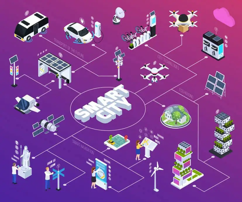
Artificial Intelligence in Urban Design
Artificial intelligence and urban design describes the application of machine learning, simulation tools, computer vision, and data analytics to the planning, design, and management of cities, neighborhoods, streets, and public spaces.
AI Urban Intervention Lab
Fixed interaction logic, stacked district mixes, and fully dynamic scores.
Average score lift after your interventions and AI optimization.
- Transit is usually the highest leverage move in this scenario.
- Signals and curb logic improve throughput without widening roads.
- Public space still matters because comfort affects adoption.
How AI Is Changing the Way Cities Are Planned and Built
The practice of urban planning has historically relied on a combination of demographic projections, zoning codes, community input, and the professional judgment of planners and designers working within political and budgetary constraints. AI is introducing a new layer of analytical capability that processes vastly more data, evaluates far more scenarios, and identifies patterns in urban systems that human analysis alone cannot detect. Machine learning models can analyze decades of census data, property records, transit ridership figures, environmental measurements, and satellite imagery to reveal how neighborhoods have evolved and predict how proposed interventions might reshape them. These tools do not replace the planner’s judgment but expand the evidence base on which that judgment rests, offering insights that were previously inaccessible due to the sheer volume and complexity of urban data. AI is transforming urban planning from a discipline constrained by the limits of human data processing into one empowered by computational analysis at a scale that matches the complexity of cities themselves. The shift is creating new possibilities for evidence-based design while also raising questions about transparency, accountability, and the values embedded in algorithmic recommendations.
The integration of AI into planning workflows is proceeding unevenly across cities and regions, reflecting differences in technical capacity, political will, data infrastructure, and regulatory environments. Large metropolitan areas with robust data collection systems and dedicated technology teams are leading adoption, while smaller cities and rural communities often lack the resources to implement AI planning tools. Singapore, Helsinki, Barcelona, and several Chinese cities have invested heavily in AI-driven planning platforms that inform decisions about land use, transportation, and public services. These early adopters are generating insights and best practices that other cities can learn from, though direct replication is rarely possible due to differences in governance structures and urban contexts. The uneven pace of adoption risks creating a digital divide in planning quality, where well-resourced cities benefit from AI insights while under-resourced communities continue to rely on outdated methods. Bridging this gap requires investment in open-source planning tools, shared data standards, and training programs that make AI capabilities accessible to planning departments of all sizes.
The relationship between AI tools and the communities they affect adds a democratic dimension that distinguishes urban planning from most other applications of artificial intelligence. Unlike a private company deploying AI for internal optimization, a city government using AI to shape neighborhoods is making decisions that affect the daily lives of millions of residents who had no role in selecting the technology. The democratic legitimacy of AI-driven planning depends on whether affected communities can understand, question, and influence the algorithmic recommendations that shape their environments. This requirement for transparency and participation creates obligations that go well beyond the technical performance of the AI system itself. Cities that deploy AI planning tools without meaningful public engagement risk undermining the social contract between government and residents that underpins legitimate urban governance. The most responsible implementations treat AI as a tool that enhances public participation rather than replacing it, using visualization and simulation capabilities to make planning decisions more accessible and comprehensible to non-expert residents.
From GIS Mapping to Machine Learning: The Technology Behind Urban AI
Urban planning has worked with geographic information systems for decades, building spatial databases that map everything from property boundaries to flood zones, transit routes, and demographic distributions. The current generation of AI tools builds on this GIS foundation by adding machine learning models that can identify patterns, make predictions, and generate recommendations from the spatial data that planning departments have accumulated over years. A GIS system can display where flooding has occurred historically, but a machine learning model trained on that data can predict where flooding will occur under future climate scenarios and evaluate which infrastructure interventions would be most effective at reducing risk. The evolution from GIS mapping to machine learning represents a shift from tools that organize and display data to tools that analyze data and generate actionable insights for planning decisions. This technological progression preserves the spatial analysis capabilities that planners rely on while adding predictive and generative capabilities that expand what planning departments can accomplish.
The technical stack powering modern urban AI includes several distinct technology categories that work together to support planning decisions across different scales and timeframes. Computer vision algorithms analyze satellite and street-level imagery to classify land use, assess building conditions, measure tree canopy coverage, and detect changes in the built environment over time. Natural language processing tools analyze public comments, community surveys, and social media posts to identify resident priorities and concerns at scale. Optimization algorithms evaluate thousands of possible configurations for transportation networks, utility systems, and land use patterns to identify solutions that balance competing objectives. These technologies integrate with existing planning software, GIS platforms, and municipal data systems to create workflows that augment rather than replace the tools planners already use. The integration challenge is significant, as many municipal data systems were designed before AI capabilities existed and require modernization to support machine learning workflows.
Generative Design Tools That Help Planners Reimagine Neighborhoods
Moving from the underlying technology to its most visible application, generative design tools are enabling urban planners to explore neighborhood configurations at a scale and speed that manual methods cannot match. Generative design in an urban context works by allowing planners to define goals such as housing density targets, green space ratios, transit accessibility thresholds, and solar exposure requirements. The AI system then produces multiple neighborhood layouts that satisfy these constraints, each representing a different balance among the competing objectives that planners must reconcile. The planner evaluates these options, combines promising elements from different proposals, and refines the most compelling directions through iterative human-AI collaboration. Generative urban design transforms the planner’s role from drafting a single proposal to curating and refining a field of algorithmically generated possibilities, expanding the creative scope of the planning process. The technology draws on the same principles driving AI in architecture but applies them at the neighborhood and district scale where the complexity of interacting systems is even greater.
The practical capabilities of generative urban design tools have advanced significantly as computing power has increased and training datasets have grown more comprehensive. Platforms like Sidewalk Labs’ Delve, Spacemaker (now Autodesk), and CityEngine allow planners to model entire districts with building footprints, street networks, open spaces, and infrastructure systems represented in three dimensions. These tools can evaluate how a proposed neighborhood will perform across dozens of metrics simultaneously, including daylight access, wind comfort, noise exposure, energy demand, and pedestrian connectivity. The speed of evaluation allows planners to test ideas that would take weeks to analyze manually, creating space for more creative exploration during the design process. Planners report that generative tools help them discover non-obvious configurations that outperform conventional layouts on multiple criteria, revealing design solutions that human intuition alone would not have identified.
The limitations of generative urban design tools are important to acknowledge because they define the boundary between what AI can contribute and what human judgment must provide. Generative systems optimize for quantifiable metrics, but many of the qualities that make neighborhoods successful resist quantification. The sense of belonging that residents feel in a well-designed community, the cultural identity expressed through architectural character and public art, and the informal social infrastructure of corner stores, barbershops, and gathering places all contribute to neighborhood quality in ways that algorithms cannot measure. Planners who rely exclusively on generative output risk producing neighborhoods that score well on technical metrics while lacking the soul and character that distinguish memorable places from generic developments. The most effective use of generative tools combines algorithmic optimization with qualitative evaluation by experienced planners who understand the lived experience of urban environments.
Community input presents another dimension that generative design tools must accommodate if their outputs are to earn public legitimacy and support. Residents possess knowledge about their neighborhoods that no dataset fully captures, including social networks, cultural practices, informal economies, and attachment to specific places and features. Generative tools that incorporate community preferences alongside technical metrics produce designs that are more likely to reflect the values and priorities of the people who will live with the results. Some platforms are developing interfaces that allow residents to adjust design parameters and see how different priorities affect neighborhood outcomes in real time. These participatory generative tools represent a promising direction that aligns AI capability with democratic planning values. The challenge lies in designing interfaces simple enough for non-expert participation while sophisticated enough to produce meaningful design exploration.
Traffic Flow Modeling and the AI Systems That Untangle Congestion
The neighborhood-scale design capabilities of generative tools connect to one of the most established applications of AI in urban planning: the modeling and optimization of transportation networks. Traffic congestion costs cities billions of dollars annually in lost productivity, increased fuel consumption, and reduced quality of life for residents who spend hours commuting. AI traffic models can simulate how thousands of individual vehicles, cyclists, and pedestrians interact across an urban network under varying conditions, predicting congestion patterns and evaluating the effectiveness of proposed interventions before they are implemented. These simulations incorporate real-time data from sensors, cameras, and GPS-enabled devices to calibrate their predictions against actual traffic behavior. AI traffic modeling gives planners the ability to test transportation interventions virtually, reducing the risk of expensive infrastructure investments that fail to deliver expected congestion relief. The sophistication of modern AI traffic management systems allows cities to optimize signal timing, transit routing, and road configurations dynamically rather than relying on fixed plans that cannot adapt to changing conditions.
The integration of AI into transportation planning extends beyond congestion management into the broader goal of designing urban mobility systems that serve all residents equitably. AI models can analyze transit accessibility gaps, identifying neighborhoods where residents lack adequate access to jobs, healthcare, and essential services due to transportation network deficiencies. These analyses reveal patterns of transportation inequity that may not be visible in aggregate statistics but become clear when data is disaggregated by income, race, and geography. Planners can use these insights to prioritize investments that address the mobility needs of underserved communities rather than defaulting to projects that benefit the most vocal or politically connected constituencies. The potential for AI to advance transportation equity depends on whether the data used to train models accurately represents the travel patterns and needs of all community members, including those who may be underrepresented in conventional data sources.
The shift toward multimodal transportation planning benefits particularly from AI’s ability to model the interactions between different movement systems within the urban environment. AI systems can evaluate how changes to bicycle infrastructure affect transit ridership, how new pedestrian zones influence traffic patterns on surrounding streets, and how ride-sharing services interact with public transportation in complex ways that defy simple prediction. The improvement of transportation and logistics through AI at the city scale requires modeling these interactions holistically rather than optimizing each mode in isolation. Cities that adopt integrated multimodal AI models are better positioned to design transportation systems that reduce car dependency, improve air quality, and create streets that serve people rather than primarily serving vehicles. The transition from car-centric to people-centric transportation planning represents one of the most consequential applications of AI in urban design.
How Satellite Imagery and Computer Vision Decode Urban Landscapes
The transportation models described above depend on accurate, current data about the physical urban environment, and satellite imagery analyzed by computer vision algorithms has become one of the most powerful sources of that data. High-resolution satellite imagery, updated regularly, provides a comprehensive view of the urban landscape that captures building footprints, road networks, vegetation coverage, water bodies, and land use patterns across entire metropolitan regions. Computer vision algorithms trained on labeled urban imagery can classify land uses, measure building heights, estimate impervious surface coverage, and detect changes in the built environment over time with accuracy that approaches or exceeds human analysis. Satellite imagery analyzed by computer vision gives planners an up-to-date, comprehensive picture of their city’s physical form that would be impossible to assemble through manual survey methods at comparable cost or speed. The technology is particularly valuable in rapidly growing cities where the pace of development outstrips the capacity of planning departments to monitor and document changes on the ground.
Street-level imagery analysis complements the bird’s-eye view provided by satellites with detailed assessments of the pedestrian environment that directly affect quality of life. Computer vision algorithms can analyze Google Street View and similar imagery to evaluate sidewalk conditions, street tree coverage, building facade quality, signage clutter, and the presence of features that contribute to or detract from walkability. Research published by MIT Media Lab has demonstrated machine learning models that predict perceived safety, attractiveness, and liveliness of streetscapes from imagery analysis, providing planners with scalable tools for assessing neighborhood quality across entire cities. These assessments can identify areas where targeted investments in streetscape improvements would have the greatest impact on resident experience and neighborhood vitality. The combination of satellite-scale and street-level analysis creates a multi-resolution picture of the urban environment that supports planning decisions at every scale from regional strategy to individual block improvements.
Digital Twins and the Power of Simulating Entire Cities
The data collected through satellite imagery, sensors, and street-level analysis reaches its full planning potential when integrated into digital twin platforms that create comprehensive virtual replicas of urban environments. A digital twin of a city is a living computational model that combines three-dimensional geometry, real-time sensor data, historical records, and predictive algorithms to simulate how the urban system behaves and how it would respond to proposed changes. Planners can use digital twins to test development scenarios, model the impact of infrastructure investments, and evaluate policy changes before committing public resources to physical implementation. The technology enables a form of urban experimentation that would be impossible in the real world, where the cost and irreversibility of construction decisions make trial-and-error approaches impractical. Digital twins give cities the ability to make mistakes virtually rather than physically, testing ideas in simulation before investing billions in infrastructure that may not perform as expected. The technology represents a fundamental shift in how cities can approach complex planning challenges.
Singapore’s Virtual Singapore project stands as the most ambitious example of a city-scale digital twin deployed for planning purposes. The platform integrates data from government agencies, research institutions, and private sector sources to create a comprehensive model of the entire city-state that supports planning analysis across transportation, energy, environment, and emergency management domains. Planners use the platform to simulate the impact of proposed developments on pedestrian comfort, wind patterns, solar exposure, and transportation network performance. The success of Virtual Singapore has inspired similar initiatives in Helsinki, Zurich, Boston, and several Chinese cities that are building digital twin platforms tailored to their specific planning needs. The investment required for a comprehensive urban digital twin is substantial, but the potential to avoid costly planning errors and optimize infrastructure investments creates a compelling return on investment case. Cities that develop mature digital twin platforms accumulate an institutional knowledge asset that improves planning quality across successive administrations and planning cycles.
Early applications of urban digital twins reveal both their transformative potential and the current limitations that define the frontier of the technology. Digital twins excel at modeling physical systems like transportation networks, energy grids, and water infrastructure where behavior can be described by well-understood physical equations and calibrated against measured data. They struggle with social systems, cultural dynamics, and political processes that influence urban outcomes as powerfully as physical infrastructure but resist mathematical modeling. A digital twin can predict how a new transit line will affect traffic patterns but cannot reliably predict how it will affect property values, community demographics, or neighborhood identity over time. These social dimensions of urban change require human judgment informed by community engagement rather than algorithmic prediction. The most effective use of digital twins combines their physical modeling capabilities with human understanding of the social, cultural, and political dimensions of urban life.
Cities Already Using AI to Shape Their Built Environments
Shifting from technology platforms to real-world implementation, a growing number of cities are deploying AI tools that directly influence decisions about their physical form and development trajectory. Barcelona has implemented an AI-powered urban platform called Decidim that combines algorithmic analysis with citizen participation to inform planning decisions about public spaces, transportation, and neighborhood development. Helsinki uses AI-driven energy modeling to evaluate the environmental performance of proposed developments and optimize district heating networks across the metropolitan area. Shenzhen has deployed computer vision analysis of satellite imagery to monitor construction activity in real time and enforce compliance with approved development plans. These early implementations demonstrate that AI is moving from research labs into the daily practice of city planning, producing measurable improvements in efficiency, sustainability, and public engagement. Each city’s approach reflects its unique governance structure, planning challenges, and technological capacity rather than a universal template for AI adoption.
Amsterdam has positioned itself as a leader in using AI for sustainable urban development through initiatives that integrate data analytics with the city’s ambitious climate and livability goals. The city’s AI-powered energy management system optimizes heating and cooling across municipal buildings, reducing energy consumption while maintaining comfort standards. Amsterdam’s mobility platform uses machine learning to analyze cycling patterns, pedestrian flows, and public transit usage, informing decisions about infrastructure investments that prioritize active transportation over car traffic. The city has also pioneered the use of AI in circular economy planning, using algorithms to identify opportunities for material reuse and waste reduction in construction and demolition projects. These applications demonstrate that AI in urban design is most effective when aligned with clear policy objectives that define what the technology should optimize for. Cities that deploy AI without articulating specific goals risk generating optimizations that serve technical efficiency rather than community values.
The adoption of AI in urban planning across developing nations presents distinct opportunities and challenges that differ significantly from the experience of wealthy cities with established data infrastructure. Cities in Sub-Saharan Africa, South Asia, and Southeast Asia face rapid urbanization with limited planning capacity, making AI tools potentially transformative for managing growth that would otherwise proceed without adequate planning oversight. Open-source platforms and satellite imagery analysis tools offer pathways for these cities to leapfrog traditional planning methods that require expensive ground surveys and extensive institutional infrastructure. The sustainability advantages of smart city approaches are particularly relevant in developing contexts where rapid urbanization threatens environmental quality and public health. The risk is that AI tools developed for wealthy cities may embed assumptions about urban form, governance capacity, and data availability that do not transfer well to different contexts. Planning AI tools must be adapted to the specific conditions of the cities they serve rather than applied as universal solutions.
Designing Walkable Communities With Data-Driven Insights
The city-level implementations described above ultimately translate into tangible improvements when AI informs the design of individual neighborhoods and streets where residents experience their daily lives. Walkability has emerged as one of the most important indicators of neighborhood quality, correlating with better health outcomes, higher property values, lower transportation costs, and stronger community social bonds. AI tools can analyze the factors that contribute to walkability with a granularity that traditional assessment methods cannot match, evaluating sidewalk connectivity, intersection density, building setbacks, shade coverage, pedestrian-scale lighting, and the mix of destinations accessible on foot. Machine learning models trained on walkability data can predict which design interventions will have the greatest impact on pedestrian activity in specific neighborhood contexts. AI-driven walkability analysis transforms pedestrian-friendly design from an aspirational goal assessed through subjective evaluation into a measurable outcome optimized through data-driven design decisions. The technology supports the growing global movement toward 15-minute city concepts, where residents can reach essential services within a short walk or bike ride.
The design of walkable communities depends not only on physical infrastructure but on the mix of land uses, building types, and street-level activity that create environments people want to walk through. AI systems can model how changes in zoning regulations, building height limits, and ground-floor use requirements affect the pedestrian experience across an entire neighborhood. These models reveal interactions between design variables that are difficult to anticipate through intuition alone, such as how increasing building height on one side of a street affects wind comfort for pedestrians or how the spacing between crosswalks influences walking route choices. Planners using AI-informed walkability analysis can calibrate their design recommendations to the specific physical and climatic conditions of each neighborhood rather than applying generic design guidelines. The precision of AI-driven analysis enables a level of customization in walkable neighborhood design that responds to local conditions while maintaining the core principles of pedestrian-friendly urbanism.
Green Infrastructure and AI-Optimized Environmental Planning
Walkability connects to a broader set of environmental design objectives that AI is helping cities pursue with greater precision and effectiveness than traditional planning methods allow. Green infrastructure, including urban forests, rain gardens, bioswales, green roofs, and permeable surfaces, provides critical ecosystem services that reduce flooding, improve air quality, mitigate heat islands, and support biodiversity within urban environments. AI tools can optimize the placement, sizing, and configuration of green infrastructure elements to maximize their environmental benefits while minimizing costs and land use conflicts. Machine learning models trained on hydrological data can predict stormwater runoff patterns across a watershed and identify the locations where green infrastructure investments will produce the greatest flood reduction benefits. AI-optimized green infrastructure planning replaces the trial-and-error approach of traditional environmental design with systematic analysis that directs investments toward the locations and configurations where they will deliver the most impact. The connection between AI and climate change mitigation is particularly tangible in urban environmental planning, where design decisions directly affect carbon emissions, energy consumption, and climate vulnerability.
Urban heat island mitigation represents a growing application of AI in environmental urban design as cities face rising temperatures driven by climate change and the thermal properties of conventional building materials. AI models can map surface temperatures across entire metropolitan regions using thermal satellite imagery, identifying heat island hotspots where intervention is most urgently needed. These models evaluate the cooling effects of different interventions, including tree planting, cool roof installations, and water features, predicting which combinations will produce the greatest temperature reductions in specific locations. The analysis accounts for building geometry, wind patterns, and land surface properties that influence how heat accumulates and dissipates within the urban environment. Cities using AI-driven heat mitigation planning can target their investments where they will provide the most relief to the most vulnerable populations, often in low-income neighborhoods where tree canopy coverage is lowest and heat-related health risks are highest. The equity dimension of heat mitigation planning aligns environmental and social justice goals in ways that strengthen the case for AI-informed environmental design.
The integration of biodiversity considerations into urban design through AI analysis represents a frontier that is gaining attention as cities recognize their role in supporting ecological systems alongside human communities. Machine learning models can analyze habitat connectivity, species distribution data, and ecological corridor potential across urban landscapes to inform green infrastructure planning that supports wildlife as well as human residents. These models identify critical gaps in ecological networks where targeted interventions such as wildlife corridors, native plantings, and wetland restoration would have the greatest impact on urban biodiversity. The approach transforms urban green space planning from an amenity-focused exercise into an ecological design practice that treats cities as components of broader regional ecosystems. Planning departments that adopt AI-driven biodiversity analysis demonstrate a level of environmental sophistication that reflects growing public demand for cities that coexist sustainably with the natural world.
Air Quality Monitoring and Real-Time Environmental Sensing
The environmental design objectives addressed through green infrastructure extend into the critical domain of air quality, where AI-powered monitoring networks are giving cities unprecedented visibility into the pollutants their residents breathe every day. Traditional air quality monitoring relied on a small number of fixed stations that measured pollution levels at specific points, leaving large gaps in coverage that obscured localized pollution hotspots in neighborhoods near highways, industrial facilities, and construction sites. AI-enabled sensor networks deploy hundreds or thousands of low-cost monitors across a metropolitan region, generating continuous data streams that machine learning models analyze to produce high-resolution air quality maps updated in real time. These maps reveal pollution patterns at the street level, identifying corridors where vehicle emissions concentrate, intersections where idling traffic creates dangerous exposure levels, and neighborhoods where industrial emissions disproportionately affect vulnerable populations. AI-powered air quality monitoring transforms environmental health protection from a reactive discipline that responds to pollution events into a proactive planning tool that informs design decisions about street layouts, building ventilation, and land use separation. The granularity of AI-driven air quality data enables planners to make evidence-based decisions about where to locate schools, parks, and residential developments relative to pollution sources.
The integration of air quality data into urban design decisions represents a growing application that connects environmental monitoring to the physical form of cities. AI models can simulate how proposed changes to street configurations, building heights, and vegetation placement will affect pollutant dispersion patterns at the pedestrian level. A planner considering the design of a new residential neighborhood near a highway can use these simulations to evaluate how buffer zones, sound walls, vegetation barriers, and building orientations affect the concentration of fine particulate matter reaching residents. These analyses inform design choices that protect public health in ways that traditional planning guidelines, which rely on fixed setback distances rather than site-specific dispersion modeling, cannot achieve. Cities that integrate air quality simulation into their design review processes can prevent the construction of housing and schools in locations where pollution levels would exceed health-protective thresholds. The approach is particularly valuable in environmental justice contexts where historically marginalized communities bear disproportionate exposure to air pollution due to the legacy of discriminatory land use planning.
Real-time air quality data also supports dynamic urban management strategies that complement the static design interventions embedded in the built environment. AI systems can trigger automated responses to air quality events, including activating enhanced ventilation in public buildings, adjusting traffic signal timing to reduce congestion in affected areas, and issuing targeted health advisories to residents of neighborhoods experiencing elevated pollution levels. These dynamic responses add a layer of environmental protection that operates continuously alongside the physical infrastructure designed to mitigate pollution. The combination of AI and IoT sensor networks creates environmental monitoring systems that are both more comprehensive and more responsive than anything previously available to urban environmental managers. Cities investing in AI-driven air quality infrastructure are building the foundation for environmental health protection systems that adapt to changing conditions rather than relying solely on fixed design standards.
Smart Waste Management and AI-Optimized Municipal Services
The environmental monitoring capabilities of AI extend beyond air and water quality into the operational systems that keep cities functional on a daily basis, with waste management standing out as one of the most immediately impactful applications. Traditional waste collection operates on fixed schedules where trucks follow predetermined routes regardless of whether containers are full, partially filled, or empty, resulting in unnecessary fuel consumption, traffic congestion, and emissions from collection vehicles. AI-powered smart waste management systems use fill-level sensors embedded in containers, dumpsters, and recycling bins to monitor waste accumulation in real time and generate optimized collection routes that visit only containers approaching capacity. Machine learning models trained on historical waste generation patterns can predict when and where waste will accumulate, enabling proactive scheduling that prevents overflow while minimizing collection trips. Smart waste management powered by AI reduces collection costs by 20 to 40 percent in documented deployments while simultaneously cutting vehicle emissions and improving street cleanliness in the neighborhoods served. The technology demonstrates how AI can improve both the efficiency and the environmental performance of essential urban services that affect every resident’s daily experience.
The urban design implications of smart waste management extend beyond operational efficiency into the planning of waste infrastructure that integrates seamlessly with the streetscape and public realm. AI analysis of waste generation patterns across a city can inform the placement, sizing, and type of waste collection infrastructure in new developments and neighborhood redesigns. Planners can use these insights to design waste systems that minimize visual and olfactory impacts on public spaces while maximizing convenience for residents and collection efficiency for municipal operators. Underground pneumatic waste collection systems, compacting bins, and neighborhood-scale composting facilities all benefit from AI-driven placement optimization that considers pedestrian flows, vehicle access routes, and proximity to sensitive uses like restaurants and parks. The integration of waste management planning into the broader urban design process reflects a maturing understanding that the quality of municipal services depends not only on operational management but on the physical infrastructure decisions made during the planning and design phases. Cities that treat waste management as a design challenge rather than merely an operational one produce cleaner, more attractive, and more functional public environments.
Climate Resilience and the Role of AI in Disaster-Ready Design
The environmental monitoring and management capabilities described above feed directly into the broader challenge of designing cities that can withstand and recover from the climate-related disasters that are increasing in frequency and severity across the globe. AI-driven climate resilience planning uses machine learning models trained on historical disaster data, climate projections, and infrastructure vulnerability assessments to identify the areas and systems most at risk from flooding, extreme heat, wildfires, and sea level rise. These models can evaluate the effectiveness of proposed resilience interventions such as sea walls, elevated roadways, improved drainage systems, and building retrofits under multiple climate scenarios spanning decades of projected change. The ability to test resilience strategies against a range of future conditions helps planners design infrastructure that performs well across plausible scenarios rather than optimizing for a single prediction that may prove inaccurate. AI climate resilience planning enables cities to prepare for uncertain futures by evaluating infrastructure investments against multiple climate scenarios simultaneously, reducing the risk of costly maladaptation. The capacity of AI to improve disaster response and risk management begins at the design phase, where planning decisions can either reduce or amplify community vulnerability for decades to come.
Flood risk modeling represents one of the most mature applications of AI in climate-resilient urban design, driven by the enormous economic and human costs of urban flooding events worldwide. AI flood models integrate terrain data, hydrological models, drainage system capacity, building footprint data, and climate projections to predict flood extent and depth under different rainfall scenarios with high spatial resolution. These predictions enable planners to identify buildings, roads, and critical infrastructure at risk and to evaluate the effectiveness of flood mitigation strategies including retention basins, levee improvements, and land use restrictions in flood-prone areas. The granularity of AI-driven flood models allows planners to move beyond broad flood zone designations to building-level risk assessments that inform zoning decisions, building code requirements, and insurance pricing. Cities that invest in AI flood modeling gain the ability to direct development away from high-risk areas and design infrastructure that manages water rather than simply channeling it downstream to create problems elsewhere.
Heat resilience planning has gained urgency as climate projections indicate that extreme heat events will become more frequent, more intense, and more prolonged in the coming decades, particularly in cities where the urban heat island effect amplifies regional temperature increases. AI models that combine climate projections, urban morphology data, and population vulnerability assessments can identify the neighborhoods and populations most at risk from extreme heat and evaluate the effectiveness of cooling interventions. These models inform decisions about tree planting programs, cool surface installations, cooling center locations, and public space design that prioritize the health and safety of vulnerable residents. The integration of heat resilience into urban design requires planners to consider how building orientations, street widths, and material choices affect thermal comfort at the pedestrian level across different seasons and times of day. AI makes this multivariable analysis feasible at scales ranging from individual blocks to entire metropolitan regions.
The intersection of climate resilience and social vulnerability demands that AI planning tools account for the unequal distribution of climate risk across different communities within a city. Low-income neighborhoods, communities of color, and areas with aging infrastructure typically face higher climate risks due to historical patterns of disinvestment, discriminatory planning practices, and proximity to environmental hazards. AI models that incorporate social vulnerability data alongside physical risk assessments can identify communities where climate resilience investments are most urgently needed and where the failure to act would perpetuate environmental injustice. This equity-centered approach to climate resilience planning uses AI to direct resources toward the communities that face the greatest risk with the fewest resources to adapt. The approach requires planners to define optimization criteria that explicitly prioritize equity alongside efficiency, ensuring that algorithmic recommendations reflect community values rather than purely technical calculations. The integration of equity into AI-driven resilience planning represents one of the most important design challenges facing urban AI practitioners today.
The Equity Problem: Who Benefits When Algorithms Plan Cities
The climate resilience discussion exposes a fundamental equity question that runs through every application of AI in urban design: whose interests do the algorithms serve, and whose voices are missing from the data that trains them. AI planning tools learn from historical data that reflects decades of discriminatory planning practices including redlining, highway construction through communities of color, exclusionary zoning, and unequal distribution of public investment across neighborhoods. Models trained on this data risk reproducing and reinforcing the very patterns of inequity that contemporary planning seeks to correct. An algorithm trained on historical development data may identify low-income neighborhoods as optimal locations for undesirable land uses because past patterns of discriminatory siting are encoded in the training data as successful precedents. The equity challenge of AI in urban design is not a technical bug to be fixed but a structural problem that requires intentional design of both the algorithms and the governance processes surrounding their use. The concern around bias and discrimination in AI is amplified in urban planning because decisions about land use, infrastructure, and public space allocation affect the health, wealth, and opportunity of entire communities for generations.
The data gaps that affect AI planning tools are not randomly distributed but follow patterns that systematically underrepresent the needs and experiences of marginalized communities. Low-income neighborhoods often have fewer sensors, less comprehensive transit data, and lower rates of participation in digital engagement platforms that generate the datasets AI tools rely upon. Informal settlements, which house hundreds of millions of people in cities across the Global South, are frequently absent from official mapping and cadastral databases entirely. AI models trained on incomplete data may ignore the needs of these communities or generate recommendations that disrupt informal systems of housing, commerce, and social support that residents depend upon. Addressing these data gaps requires intentional investment in data collection that prioritizes underrepresented communities and includes qualitative information gathered through community engagement alongside quantitative datasets. The quality and inclusivity of the data determine whether AI planning tools advance equity or entrench existing disparities.
The question of who designs the optimization criteria for AI planning tools is fundamentally a question of political power that technology alone cannot resolve. When a planner programs an AI system to optimize a neighborhood layout, every criterion and weight reflects a value judgment about what matters most. Optimizing for tax revenue produces different neighborhoods than optimizing for affordable housing access, public health, or cultural preservation. The technical act of defining optimization parameters is a political act that determines winners and losers, and it must be subject to democratic accountability. Communities affected by AI-driven planning decisions deserve a voice in defining what the algorithms should optimize for, not merely a chance to comment on the results. The most equitable implementations of urban AI involve communities in the design of optimization criteria from the beginning, treating algorithmic planning as a tool for implementing democratically determined priorities rather than a substitute for democratic deliberation.
Gentrification, Displacement, and the Blind Spots of Urban AI
The equity concerns described above take their most concrete form in the relationship between AI-optimized urban design and the displacement of existing residents through gentrification driven by neighborhood improvements. AI tools that identify undervalued neighborhoods for infrastructure investment may accelerate gentrification by attracting development to areas where existing residents are vulnerable to rising rents and property values. The algorithms identify opportunity in the gap between current conditions and potential value, but they cannot see the human cost of closing that gap through market forces that displace long-term residents, small businesses, and community institutions. Planners using AI to target neighborhood improvements must account for displacement risk alongside physical improvement metrics, ensuring that the benefits of investment reach existing residents rather than primarily enriching new arrivals. AI urban design tools that optimize for neighborhood improvement without accounting for displacement risk become instruments of gentrification that use the language of progress to justify the disruption of vulnerable communities. The blind spot is not in the technology itself but in the failure to include displacement prevention as a core design requirement.
The predictive capabilities of AI could be directed toward gentrification prevention rather than unintentional gentrification acceleration if planners chose to frame the problem differently. Machine learning models can identify neighborhoods exhibiting early indicators of displacement pressure, including rapid property value increases, demographic shifts, commercial rent escalation, and changes in building permit activity. These early warning systems give planners time to implement protective measures such as inclusionary zoning, community land trusts, right-of-first-refusal policies, and targeted affordable housing investments before displacement reaches crisis levels. The technology that currently contributes to displacement by identifying investment opportunities could be repurposed to protect communities by identifying displacement threats. This reframing requires a deliberate choice by planners and elected officials to prioritize community stability alongside neighborhood improvement. The tools exist to make gentrification-sensitive planning a reality; what is needed is the political commitment to deploy them for that purpose.
AI in Urban Regeneration and Brownfield Redevelopment
The displacement concerns raised by gentrification connect to a parallel application of AI in urban design that carries enormous potential when directed toward the revitalization of abandoned, contaminated, or underused sites rather than the disruption of functioning communities. Urban regeneration projects that transform brownfield sites, derelict industrial areas, and vacant land into productive community assets represent one of the most socially valuable applications of AI-driven planning. Machine learning models can analyze environmental contamination data, soil conditions, groundwater flows, and remediation costs to determine the feasibility and optimal sequencing of brownfield redevelopment across an entire metropolitan region. These analyses help cities prioritize regeneration investments toward sites where the combination of remediation costs, development potential, and community benefit creates the strongest case for public investment. AI-driven brownfield analysis accelerates urban regeneration by compressing the site assessment timeline from months to weeks while identifying redevelopment opportunities that manual analysis might overlook entirely. The technology is particularly valuable in post-industrial cities where hundreds of contaminated sites sit vacant while surrounding communities lack access to jobs, green space, and essential services.
The design phase of urban regeneration projects benefits from the same generative tools and simulation capabilities that support new neighborhood development, but with additional complexity introduced by existing site conditions and community history. AI tools can model how proposed regeneration designs will interact with surrounding neighborhoods, evaluating impacts on traffic patterns, property values, environmental quality, and community access to new amenities. Digital twin platforms enable planners to test regeneration scenarios that preserve historic structures, integrate contamination remediation with public space design, and phase development to minimize disruption to adjacent communities during construction. The technology supports designs that honor the industrial heritage of regeneration sites through adaptive reuse of existing structures rather than wholesale demolition, a approach that preserves community identity while reducing construction waste and embodied carbon. Regeneration projects that balance new development with heritage preservation tend to generate stronger community support and produce more distinctive neighborhoods than those that erase the past entirely.
The social dimensions of urban regeneration demand that AI tools account for the needs and aspirations of communities adjacent to regeneration sites who have often waited decades for investment in their neighborhoods. These communities frequently include low-income residents and communities of color who were historically exposed to the environmental hazards of the industrial uses that preceded the current vacancy. AI-driven community needs assessments can analyze demographic data, public health records, employment patterns, and service accessibility to identify the amenities and opportunities that regeneration projects should prioritize for surrounding residents. The technology can also model the displacement risks that regeneration may create by attracting new investment to previously undervalued areas, enabling planners to design protective measures alongside physical improvements. Responsible AI-driven regeneration treats existing community members as the primary beneficiaries of redevelopment rather than obstacles to be relocated for the convenience of new residents and investors. The integration of environmental remediation, community benefit planning, and displacement prevention represents the most sophisticated application of AI in urban regeneration practice.
Surveillance Infrastructure Hidden Inside Smart City Projects
The regeneration and equity concerns examined in previous sections take on additional dimensions when AI-driven urban design projects include surveillance infrastructure that raises profound civil liberties questions often obscured by the language of efficiency and safety. Smart city projects that deploy sensors, cameras, and data collection systems throughout public spaces generate continuous streams of information about how residents move through, use, and interact with the urban environment. When this data is aggregated and analyzed through AI systems, it creates a surveillance apparatus capable of tracking individual movements, identifying behavioral patterns, and predicting future activities with a granularity that residents may not realize or consent to. The infrastructure is typically justified as necessary for traffic management, public safety, environmental monitoring, or service delivery optimization, but the same systems can be repurposed for law enforcement surveillance, political monitoring, or commercial data exploitation. The surveillance potential of smart city infrastructure demands that AI urban design projects include explicit privacy protections, data governance frameworks, and civilian oversight mechanisms from the earliest stages of planning. The privacy concerns surrounding AI in urban environments are particularly acute because public space surveillance affects every resident, including those who would never consent to individual monitoring.
The global variation in how cities handle surveillance infrastructure reflects different political systems, cultural norms around privacy, and regulatory frameworks that govern data collection in public spaces. Chinese smart city projects have integrated extensive surveillance networks that use facial recognition, gait analysis, and behavioral pattern detection as core components of urban management systems. European cities operating under GDPR restrictions face stronger privacy constraints that limit the types of data that can be collected and how they can be used, though enforcement varies across jurisdictions. Cities in the United States occupy a middle ground where surveillance deployment varies widely by municipality, with some cities banning facial recognition technology while others expand it. These different approaches create natural experiments that researchers and policymakers can study to understand the relationship between surveillance intensity, public safety outcomes, and civil liberties protection. The evidence suggests that effective urban management does not require comprehensive surveillance and that cities can achieve safety and efficiency goals through privacy-respecting approaches that collect aggregate data rather than individual-level tracking.
The design of urban AI systems that protect privacy while delivering planning benefits requires technical approaches that address privacy at the architectural level rather than relying solely on policy restrictions. Differential privacy techniques add statistical noise to data that prevents individual identification while preserving aggregate patterns useful for planning analysis. Edge computing processes sensor data locally and transmits only anonymized summaries to central systems, reducing the risk of privacy breaches from centralized data repositories. Federated learning allows AI models to be trained on distributed data without that data ever being collected in a single location. These technical privacy protections complement regulatory frameworks by making privacy violations technically difficult rather than merely legally prohibited. Urban AI systems designed with privacy-preserving architecture demonstrate that surveillance is a choice rather than an inevitable consequence of intelligent urban infrastructure.
Understanding Urban Demographics With AI-Driven Analysis
The privacy-preserving approaches described above enable a powerful analytical application of AI that uses demographic data to ensure that urban design serves the actual populations living in each neighborhood rather than assumed or outdated demographic profiles. AI-driven demographic analysis integrates census records, mobile phone mobility data, public health statistics, school enrollment figures, and economic indicators to build detailed portraits of community composition that inform planning decisions at the neighborhood scale. These analyses reveal how population characteristics including age distribution, household size, income levels, language diversity, and disability prevalence vary across a city in patterns that directly affect what types of housing, public spaces, transportation options, and community facilities each neighborhood needs. Machine learning models can identify demographic trends that signal emerging needs, such as a neighborhood experiencing rapid growth in elderly residents who will soon require accessible streetscapes, healthcare facilities, and public transit options designed for reduced mobility. AI-driven demographic analysis gives planners the ability to design for the communities that actually exist and the communities that are emerging rather than relying on generalized assumptions about who lives in a given area. The precision of this analysis enables a level of responsiveness in urban design that generic planning standards cannot achieve.
The predictive dimension of demographic analysis allows planners to anticipate future community needs and design infrastructure that will remain relevant as populations evolve over the decades-long lifespan of urban infrastructure. AI models can project how migration patterns, aging trends, birth rates, and economic shifts will change the composition of specific neighborhoods over 10, 20, or 30 year timeframes. These projections inform decisions about school capacity, park amenities, transit service levels, and housing types that must serve communities whose characteristics will differ significantly from today’s residents. A neighborhood currently dominated by young families may transition to an older population within two decades, requiring design choices that accommodate both current and future needs. The temporal dimension of demographic planning is critical because urban infrastructure built today will serve communities for generations, and design decisions that serve only current demographics risk becoming obsolete or inappropriate as populations change. AI-driven demographic forecasting enables a forward-looking approach to urban design that traditional methods, which typically rely on current census snapshots, cannot provide.
Enhancing Accessibility and Inclusion Through AI in Urban Design
The demographic analysis capabilities described above take on particular urgency when applied to the needs of residents with disabilities, whose requirements for accessible urban environments have historically been addressed through minimum compliance with building codes rather than through intentional, data-driven design. AI tools can analyze the accessibility of urban environments with a comprehensiveness and granularity that manual auditing cannot match, evaluating sidewalk widths, curb cut placements, crosswalk signal timing, ramp gradients, tactile paving conditions, and the availability of accessible transit stops across entire cities. Computer vision algorithms can scan street-level imagery to identify accessibility barriers including cracked sidewalks, obstructed curb cuts, missing tactile indicators, and inadequate lighting that create hazards for wheelchair users, visually impaired pedestrians, and elderly residents with mobility limitations. These automated assessments produce citywide accessibility maps that identify priority areas for investment and inform the design of new neighborhoods with universal accessibility as a core design principle rather than a regulatory afterthought. AI-driven accessibility analysis transforms the design of inclusive urban environments from a compliance exercise focused on minimum standards into a proactive planning practice that optimizes public spaces for the full range of human physical and sensory capabilities. The technology enables cities to identify and address the thousands of small barriers that collectively determine whether residents with disabilities can navigate their communities independently and with dignity.
The design of accessible public transit systems benefits from AI analysis that models the entire journey experience of riders with different types of disabilities. AI tools can simulate how a wheelchair user, a visually impaired commuter, or an elderly rider with limited stamina experiences the transit system from origin to destination, identifying pain points including inaccessible stations, vehicles without adequate space, connections requiring excessive walking distances, and intersections with inadequate crossing times. These simulations inform targeted investments in accessibility improvements that address the most impactful barriers first rather than spreading resources thinly across improvements of varying significance. The technology also supports real-time accessibility information systems that alert riders with disabilities to service disruptions, elevator outages, and alternative accessible routes, ensuring that the information infrastructure of transit systems serves all users equitably. Cities that invest in AI-driven transit accessibility analysis demonstrate a commitment to inclusion that goes beyond physical infrastructure to encompass the information and navigation systems that determine whether accessible infrastructure can actually be used effectively.
Digital accessibility in urban planning processes themselves represents a third dimension of inclusion that AI tools can support through design choices that ensure all residents can participate in shaping their communities. Planning websites, public engagement platforms, and digital visualization tools must be designed to meet accessibility standards that enable participation by residents using screen readers, voice navigation, keyboard-only interfaces, and other assistive technologies. AI-powered tools can automatically evaluate the accessibility of digital planning platforms, identifying barriers that prevent residents with disabilities from participating in online engagement processes. The technology can also generate alternative content formats, including audio descriptions of visual planning materials, simplified language versions of technical documents, and translations for linguistically diverse communities. Inclusive urban design begins with inclusive planning processes, and AI tools that ensure digital accessibility in public engagement create the conditions for planning outcomes that reflect the needs of all community members. The integration of physical accessibility, transit accessibility, and digital accessibility into a comprehensive AI-driven inclusion strategy represents the most complete approach to designing cities that serve everyone.
How Public Participation Can Coexist With Algorithmic Planning
The accessibility and demographic insights described above underscore the critical importance of public participation in AI-driven urban design processes that affect community life. Traditional public participation in urban planning takes the form of community meetings, public hearings, and comment periods that often attract only a small, unrepresentative fraction of affected residents. AI-powered participation platforms have the potential to broaden engagement by offering digital tools that allow residents to explore planning scenarios, express preferences, and provide feedback on proposed changes through accessible online interfaces. These platforms can reach residents who cannot attend evening meetings due to work schedules, childcare responsibilities, or mobility limitations, expanding the demographic diversity of participants in the planning process. AI-enhanced public participation can make planning more democratic by removing barriers to engagement, but only if the platforms are designed with the specific needs and digital access patterns of underserved communities in mind. The technology must lower barriers rather than creating new ones that favor digitally connected, English-speaking, and technically literate populations.
The integration of AI analysis with community input creates opportunities for planning processes that are both more analytically rigorous and more democratically responsive than either approach alone. AI tools can analyze public input at scale, identifying themes, priorities, and areas of consensus and disagreement across thousands of comments and survey responses. This analysis helps planners understand community sentiment with a breadth and granularity that manual review of public comments cannot achieve. The danger lies in using AI analysis of public input to replace rather than supplement direct engagement, reducing the rich, contextual knowledge that residents share in face-to-face interactions to data points in an algorithmic model. Planners must resist the temptation to treat AI analysis of public input as a substitute for the deliberative processes through which communities negotiate competing interests and build shared understanding. The most effective participatory planning processes use AI to extend and deepen engagement while preserving the spaces for human dialogue that democracy requires.
The design of participatory AI platforms must account for the digital divide that separates communities with reliable internet access, current devices, and digital literacy from those lacking these resources. A planning participation platform that exists only online excludes residents without internet access or digital skills, reproducing the participation gaps that traditional processes already exhibit. Effective platforms offer multiple participation pathways, including in-person kiosks, phone-based surveys, and community workshops alongside digital interfaces, ensuring that no group is systematically excluded. The investment in multi-channel participation infrastructure signals a commitment to inclusion that builds trust between planning agencies and the communities they serve. Cities that combine AI analytical capabilities with genuinely inclusive participation processes can achieve planning outcomes that are both technically excellent and democratically legitimate. The goal is not to choose between algorithmic analysis and public participation but to integrate them in ways that strengthen both.
Zoning Optimization and the Tension Between Efficiency and Character
Public participation becomes especially important when AI tools are applied to zoning decisions that determine what can be built where and how neighborhoods look and function over time. AI zoning optimization tools can analyze the interactions between land use designations, transportation patterns, economic activity, environmental performance, and housing production to recommend zoning configurations that maximize specific objectives. The technology can identify where increased density would be most efficiently served by existing transit infrastructure, where mixed-use development would generate the most pedestrian activity, and where industrial uses should be relocated to reduce residential exposure to pollution and noise. AI zoning optimization reveals opportunities for more efficient land use patterns that human analysis might miss, but efficiency must be balanced against the neighborhood character, cultural identity, and community preferences that make each place distinctive. The tension between optimization and character defines one of the most sensitive applications of AI in urban design.
The zoning decisions that AI tools inform are among the most politically consequential actions that local governments take, directly affecting property values, housing costs, neighborhood demographics, and the economic viability of local businesses. An AI system that recommends upzoning a residential neighborhood for higher density development may be technically correct about the efficiency of that change but politically explosive if the recommendation conflicts with community preferences for maintaining existing neighborhood character. Planners must navigate between the analytical insights AI provides and the political realities of zoning decisions that redistribute value and opportunity across communities. The most effective approach treats AI zoning analysis as one input among many in a deliberative process that includes community engagement, political negotiation, and professional planning judgment. Zoning decisions that emerge from transparent processes combining AI analysis with democratic deliberation are more likely to be implemented successfully than those imposed through purely technocratic reasoning.
AI and the Economics of Affordable Housing Design
Zoning decisions connect directly to the housing affordability crisis that AI is being deployed to address through more efficient design, construction, and land use planning. AI tools can optimize affordable housing designs to reduce construction costs while maintaining livability standards, analyzing thousands of floor plan configurations to identify layouts that maximize unit count and quality within fixed budgets. Generative design platforms can produce affordable housing configurations that balance density, natural light access, ventilation, privacy, and common space in ways that conventional design processes might not explore. The technology helps housing developers and nonprofit affordable housing organizations stretch limited budgets further by identifying cost savings in building geometry, structural systems, and material selections. AI-driven affordable housing design has the potential to close the gap between the housing that communities need and the housing that constrained budgets can deliver, making quality design accessible to income levels that the private market underserves. The application draws on the same generative design principles that serve commercial architecture but directs them toward one of the most pressing social challenges facing cities worldwide.
The economics of affordable housing extend beyond individual building design to the land use and infrastructure decisions that determine where affordable housing can be built and how much it costs to develop. AI tools can analyze land costs, infrastructure capacity, transit accessibility, and regulatory requirements across an entire metropolitan region to identify sites where affordable housing development would be most financially feasible and most beneficial to residents. This analysis helps housing agencies target their limited acquisition and development budgets toward locations that offer the best combination of affordability and access to jobs, schools, and services. The technology also supports the design of mixed-income developments that integrate affordable units within market-rate projects in ways that maintain financial viability while advancing inclusionary housing goals. Cities that use AI to inform affordable housing strategy can make more impactful investments with the same level of public funding.
The relationship between AI-driven urban design and affordable housing is complicated by the reality that neighborhood improvements often increase property values and housing costs, potentially undermining affordability in the very communities where investment is targeted. AI tools that optimize neighborhood design for walkability, green space, and transit access may inadvertently make those neighborhoods more attractive to higher-income residents and investors, driving up costs and displacing the lower-income residents the improvements were intended to serve. Addressing this paradox requires planners to pair physical design improvements with policy tools that protect affordability, including rent stabilization, community land trusts, inclusionary zoning requirements, and targeted subsidies for existing residents. AI can model the expected impact of different policy combinations on housing costs and displacement risk, helping planners design intervention packages that improve neighborhoods without pricing out the people who live there. The integration of physical design, housing policy, and displacement prevention represents the frontier of equitable urban AI practice.
What Happens When Urban AI Gets the Design Wrong
The housing affordability challenge illustrates one way urban AI can produce unintended consequences, but a broader examination of AI planning failures reveals patterns that cities must learn from to avoid repeating. AI urban design failures typically fall into categories that reflect systematic weaknesses in how the technology is deployed rather than random technical malfunctions. Data failures occur when the information used to train models is incomplete, biased, or outdated, producing recommendations that do not reflect current conditions or community needs. Optimization failures occur when the criteria programmed into the system capture only a subset of the factors that determine neighborhood quality, producing outcomes that score well on measured metrics while failing on unmeasured but important dimensions. Governance failures occur when AI recommendations are implemented without adequate public scrutiny, community input, or political accountability, undermining the democratic legitimacy of planning decisions. AI urban design failures are most dangerous when they go undetected because the technology produces outputs that appear authoritative and objective, masking the limitations and biases embedded in the system’s design. The sophistication of AI outputs can create a false sense of precision that discourages the critical scrutiny necessary for responsible planning.
The consequences of AI planning errors in urban design are particularly severe because urban infrastructure is expensive, long-lasting, and difficult to reverse once constructed. A road built in the wrong location, a park placed where no one uses it, or a transit line routed through a low-demand corridor represents a misallocation of public resources that constrains a city’s options for decades. The permanence of urban infrastructure means that AI planning errors can lock cities into suboptimal configurations that are far more costly to correct than to have avoided in the first place. This reality demands that cities approach AI-driven planning with appropriate caution, treating algorithmic recommendations as inputs to human judgment rather than as authoritative directives. The validation of AI planning recommendations through multiple analytical methods, community feedback, and expert review creates redundancy that catches errors before they are encoded in concrete and steel.
Transparency about AI limitations and uncertainty is essential for responsible urban design practice but conflicts with the institutional incentives that encourage planning agencies to present AI tools as authoritative and precise. Planners who acknowledge the limitations of their AI tools may face pressure from elected officials and the public to justify the investment in technology that does not produce certainty. This pressure can lead to the suppression of uncertainty information and the presentation of AI recommendations with false confidence that undermines informed decision-making. The most responsible planning agencies communicate AI tool limitations clearly, present ranges of outcomes rather than single predictions, and document the assumptions and data sources underlying their analyses. Transparency about uncertainty does not undermine public confidence in planning; it builds trust by demonstrating intellectual honesty and professional integrity. Cities that develop cultures of transparent AI use position themselves to learn from errors and improve their practice over time rather than defending flawed decisions that erode public trust.
The accumulation of case study evidence from AI planning projects worldwide is creating a knowledge base that helps cities avoid documented pitfalls and adopt proven approaches. Professional organizations including the American Planning Association, the Royal Town Planning Institute, and UN-Habitat are developing guidelines for AI use in urban planning that synthesize lessons from early adopters. Academic researchers are publishing evaluations of AI planning projects that assess both their technical performance and their social outcomes, providing evidence that informs best practices. The sharing of failure stories is as valuable as the sharing of success stories because it helps cities avoid repeating mistakes that others have already made. The urban planning profession’s willingness to learn publicly from AI implementation experiences will determine how quickly the field develops the maturity needed to deploy these powerful tools responsibly.
Regulatory Frameworks Governing AI in City Planning
The lessons from both successes and failures are informing the development of regulatory frameworks that govern how AI can be used in urban planning decisions affecting public welfare. The European Union’s AI Act classifies certain AI applications as high-risk, and AI systems used for infrastructure management and public service delivery in urban contexts may fall within categories that require transparency, documentation, and human oversight. Cities operating under EU jurisdiction must ensure that their AI planning tools comply with requirements for algorithmic impact assessment, data quality documentation, and the right of affected individuals to understand how automated decisions affect them. The emerging regulatory landscape for AI in urban planning reflects a growing recognition that algorithmic decisions about cities carry public welfare implications that demand governance structures comparable to those applied to other consequential government functions. The regulation of AI in urban design must balance the technology’s potential to improve planning outcomes with the need to protect communities from algorithmic harms.
National and local governments are developing complementary regulatory approaches that address the specific ways AI is used in urban planning within their jurisdictions. Canada’s federal AI strategy includes provisions for responsible AI deployment in public sector applications including urban planning and infrastructure management. New York City’s Automated Decision Systems Task Force recommended transparency requirements for algorithms used by city agencies that could influence service delivery, zoning, and infrastructure decisions. Barcelona has established a digital rights framework that includes provisions for algorithmic transparency and citizen data sovereignty in the context of smart city initiatives. These varied regulatory approaches reflect different legal traditions, governance structures, and political priorities, creating a diverse ecosystem of regulatory experimentation. Cities and national governments can learn from each other’s regulatory innovations, adapting approaches that prove effective to their own institutional contexts.
Self-regulatory initiatives within the planning profession complement governmental regulation by establishing professional standards for AI use that go beyond minimum legal requirements. The American Planning Association has published guidance on ethical AI use in planning that addresses transparency, equity, community engagement, and professional accountability. International organizations including UN-Habitat and the OECD have developed principles for AI in urban governance that emphasize human oversight, inclusivity, and the protection of rights. These professional standards create a normative framework that shapes how planners approach AI adoption even in the absence of binding regulation. The combination of governmental regulation, professional standards, and institutional best practices creates a multi-layered governance system that addresses the complexity of AI’s role in shaping the urban environment. Planners who adhere to both legal requirements and professional ethical standards demonstrate the level of responsibility that the public stakes of urban AI demand.
Lessons From Cities That Led and Stumbled in AI Adoption
Regulatory frameworks provide the governance structure, but the most practical guidance for cities adopting AI comes from examining the experiences of early adopters who have navigated implementation challenges in real-world conditions. Singapore’s comprehensive approach to urban AI, centered on its Virtual Singapore digital twin platform, demonstrates the benefits of sustained institutional investment, cross-agency data sharing, and clear governance structures. The city-state’s small size, centralized governance, and high technical capacity create conditions for AI adoption that are difficult to replicate in larger, more politically fragmented cities. Barcelona’s Decidim platform illustrates how AI-enhanced citizen participation can strengthen democratic planning processes while generating data that improves algorithmic recommendations over time. The city’s commitment to digital rights and data sovereignty provides a governance model that protects residents while enabling innovation. The most instructive lessons come from cities that have been transparent about both their successes and their struggles, providing practical guidance that helps other cities avoid documented pitfalls. The ethics and laws governing AI provide a foundation, but practical wisdom comes from implementation experience.
The cautionary experiences of cities where AI deployment encountered resistance or produced unintended consequences are equally valuable for the profession’s collective learning. Toronto’s Sidewalk Labs Quayside project demonstrated that ambitious AI-driven urban design cannot succeed without community trust, transparent governance, and clear public accountability for data practices. The project’s cancellation in 2020, driven primarily by unresolved concerns about data governance and corporate control over public infrastructure, established that technical capability alone is insufficient for AI-driven urban development. Kansas City’s early smart city sensor deployment drew criticism when residents learned that the data collected for traffic management could be accessed by law enforcement without clear judicial oversight. These cautionary tales illustrate that the social contract between cities and residents must be explicitly addressed before AI tools are deployed in public spaces. The failure to establish trust before deployment is far more damaging than delaying deployment until governance structures are in place.
The emerging best practices from both successful and unsuccessful implementations converge on several principles that cities at any stage of AI adoption can apply. First, AI deployment should be driven by clearly defined planning objectives rather than technology acquisition for its own sake. Second, affected communities must be involved in defining both the goals and the governance of AI planning tools. Third, transparency about data sources, algorithmic methods, and system limitations builds trust that enables sustained public support. Fourth, equity must be an explicit design criterion rather than an afterthought, with systematic bias auditing built into every AI planning workflow. Fifth, privacy-preserving technical architectures should be required from the outset rather than retrofitted after deployment. These principles are not novel in the context of good planning practice; they are the application of longstanding planning values to a new technological context. Cities that ground their AI adoption in established planning ethics will produce better outcomes than those that treat AI as a break from traditional practice.
The Future of Human-AI Partnership in Shaping Cities
The principles distilled from early adoption experiences point toward a future where the relationship between human planners and AI systems matures into a genuine partnership that leverages the strengths of both. Human planners bring contextual knowledge, political awareness, ethical reasoning, cultural sensitivity, and the ability to navigate the messy, contested, and deeply personal dimensions of decisions about place and community. AI systems bring computational power, data processing capacity, pattern recognition, scenario generation, and the ability to evaluate thousands of options against complex criteria simultaneously. The most effective urban design will emerge from workflows where AI handles analysis and scenario generation while human planners handle judgment, values, and the integration of community voice into design decisions. This partnership model preserves democratic accountability while expanding the analytical capacity of planning agencies beyond what either humans or machines could achieve alone. The future of artificial intelligence and urban design is not a choice between algorithmic efficiency and human judgment but a partnership that integrates both to produce cities worthy of the people who inhabit them.
Emerging technologies will expand the scope of this partnership in ways that are beginning to take shape in research labs and pilot projects around the world. Real-time urban sensing networks will feed continuous data streams into AI models that monitor city performance and alert planners to emerging issues before they become crises. Augmented reality tools will allow planners and community members to visualize proposed changes in their actual physical context, evaluating how new buildings, parks, and streets will look and feel in the real environment rather than in abstract renderings. AI agents capable of integrating data from transportation, energy, water, and social service systems will enable holistic planning that addresses the interconnected nature of urban challenges. These capabilities will demand planners with strong analytical skills, ethical grounding, and the communication ability to translate between algorithmic outputs and community aspirations. The planning profession is evolving toward a model where technical AI literacy and humanistic design values are equally essential competencies.
The cities that emerge from the AI era of urban planning will be judged not by the sophistication of the technology that shaped them but by the quality of life they provide to their residents, particularly those with the fewest resources and the least political power. A city optimized by AI that serves only its wealthiest residents while neglecting its poorest is a failure regardless of its technical elegance. A city that uses AI to expand access to green space, improve transit equity, reduce climate vulnerability, and design neighborhoods where people of all incomes can thrive is a success that validates the technology’s potential. The stakes are high because cities built today will shape human experience for generations, outlasting the algorithms and platforms that influenced their design. Artificial intelligence and urban design together hold the potential to produce cities that are more equitable, more resilient, and more responsive to human needs than anything the planning profession has achieved through traditional methods alone. Realizing that potential is the defining challenge for the next generation of urban planners, technologists, and the communities they serve.
Key Insights
- A Bloomberg Cities analysis found that cities using AI-driven occupancy and traffic data reduced infrastructure investment waste by up to 25 percent compared to those relying on traditional forecasting methods.
- UN-Habitat projects that 68 percent of the global population will live in urban areas by 2050, making AI-optimized urban design a critical lever for managing the quality of life for billions of people.
- Singapore’s Virtual Singapore digital twin platform integrates data from over 20 government agencies, creating one of the most comprehensive urban simulation environments deployed for planning purposes worldwide.
- Research from MIT Senseable City Lab has demonstrated machine learning models that predict perceived streetscape safety and attractiveness from imagery with accuracy rates comparable to human evaluators.
- Barcelona’s Decidim platform has engaged over 400,000 participants in urban planning processes, demonstrating that AI-enhanced civic engagement can scale public participation beyond traditional methods.
- The World Economic Forum estimates that AI-optimized urban infrastructure could reduce city energy consumption by up to 15 percent and transportation-related emissions by up to 20 percent.
- AI-driven flood modeling has enabled cities like Copenhagen and Rotterdam to design climate adaptation infrastructure that reduces flood damage costs by billions of euros over projected infrastructure lifespans.
- The American Planning Association published guidance on ethical AI use in planning, establishing professional standards that address transparency, equity, and community engagement in algorithmic planning.
| Dimension | Traditional Urban Planning | AI-Augmented Urban Planning |
|---|---|---|
| Data Analysis | Census data, manual surveys, periodic studies | Real-time sensor data, satellite imagery, continuous analytics |
| Scenario Testing | Limited to 2-3 manual scenarios per project | Hundreds or thousands of scenarios evaluated computationally |
| Community Engagement | Public hearings, comment periods, limited participation | Digital platforms, AI-analyzed feedback, scalable participation |
| Traffic Planning | Traffic counts, manual modeling, fixed signal timing | Real-time simulation, adaptive signal optimization, multimodal integration |
| Environmental Analysis | Site-specific studies, general guidelines | AI-optimized green infrastructure, heat mapping, biodiversity modeling |
| Climate Resilience | Flood zone maps, historical risk assessment | Multi-scenario climate modeling, building-level risk prediction |
| Equity Assessment | Qualitative review, community feedback | Data-driven disparity analysis, vulnerability mapping, bias auditing |
| Zoning Decisions | Code-based review, political negotiation | AI-optimized land use analysis balanced with community input |
Real-World Examples
Barcelona Decidim and AI-Enhanced Civic Participation
Barcelona developed Decidim, an open-source digital democracy platform that combines AI-powered analysis with citizen participation to inform urban planning decisions. The platform has engaged over 400,000 residents in processes including participatory budgeting, neighborhood planning, and strategic urban development consultations. AI tools within the platform analyze public submissions at scale, identifying themes, areas of consensus, and emerging priorities that help planners understand community sentiment with breadth impossible through traditional comment review. The initiative demonstrated that technology can broaden democratic participation in planning while generating data that improves the analytical quality of planning decisions. A limitation is that digital participation skews toward younger, more educated residents, requiring supplementary outreach efforts to ensure inclusive representation. The platform’s open-source architecture has been adopted by over 150 organizations globally, as documented on Decidim’s website.
Singapore Virtual Singapore Digital Twin
Singapore’s National Research Foundation invested in Virtual Singapore, a comprehensive digital twin of the entire city-state that integrates data from transportation, energy, environmental monitoring, and government services. Planners use the platform to simulate the impact of proposed developments on wind comfort, solar access, pedestrian flows, and transportation network performance before construction begins. The platform has supported planning decisions for major developments including the Tengah “forest town” and Jurong Lake District redevelopment, where digital simulation informed building placement and public space design. The project demonstrated that sustained government investment in data infrastructure and cross-agency collaboration can produce planning tools of extraordinary analytical power. A limitation is that the platform’s success depends on Singapore’s uniquely centralized governance, which may not translate to cities with fragmented political authority. Details are available through Singapore’s National Research Foundation.
Copenhagen Climate Adaptation and AI Flood Modeling
Copenhagen deployed AI-driven flood modeling across the metropolitan region after experiencing catastrophic urban flooding that caused billions in damage. The AI system integrates terrain data, drainage capacity analysis, rainfall projections, and sea level rise scenarios to predict flood risk at street-level resolution across the city. The models informed the design of Copenhagen’s Cloudburst Management Plan, which combines green infrastructure, water retention systems, and flood-adapted street designs to manage extreme rainfall events. The AI-optimized approach directed investment toward the locations where interventions would produce the greatest flood risk reduction per dollar spent, maximizing the impact of limited public budgets. A limitation was that the models performed less reliably for compound events combining heavy rainfall with coastal storm surge, requiring ongoing calibration as climate data improves. The initiative is documented through the European Climate Adaptation Platform.
Case Studies
Sidewalk Labs Quayside, Toronto, Technology Ambition Meets Democratic Resistance
Sidewalk Labs, an Alphabet subsidiary, proposed Quayside as a 12-acre smart neighborhood on Toronto’s eastern waterfront featuring AI-managed energy systems, modular construction, and continuous data collection for urban optimization. The project planned to use sensors embedded throughout public spaces to monitor pedestrian flows, energy usage, weather conditions, and transportation patterns, feeding the data into AI systems that would optimize neighborhood operations in real time. Community groups, privacy advocates, and the Canadian Civil Liberties Association raised concerns about data governance, arguing that corporate control over public space data undermined democratic accountability and resident privacy. Waterfront Toronto’s own digital strategy advisory panel identified significant gaps in the project’s data governance framework and recommended stronger public oversight mechanisms. Sidewalk Labs withdrew from the project in May 2020, citing economic uncertainty from the pandemic, though most observers attributed the withdrawal to unresolvable governance disputes. The Quayside experience established that technical ambition without community trust and transparent governance cannot sustain AI-driven urban projects. The case is documented by the Canadian Civil Liberties Association and Waterfront Toronto.
Helsinki 3D City Model and Energy Optimization
Helsinki developed a detailed 3D city model integrating building data, energy consumption records, and climate projections to optimize district heating networks and evaluate the energy performance of proposed developments across the metropolitan area. The AI-driven energy model enables planners to simulate how new buildings will affect district heating demand, identify opportunities for waste heat recovery, and evaluate the impact of building retrofit programs on neighborhood-level carbon emissions. The initiative has informed Helsinki’s carbon neutrality strategy, which aims to make the city carbon neutral by 2035 through integrated energy, transportation, and land use planning. The model identified that coordinating building retrofits at the neighborhood scale rather than the individual building scale produced significantly greater energy savings due to system-level optimization effects. A limitation was that the model’s accuracy depended on the quality of building-level energy data, which varied significantly across the city’s building stock. Helsinki’s approach is documented through the Helsinki 3D city model portal.
Medellin Urban AI for Social Equity
Medellin, Colombia deployed AI-driven urban analysis to address deep spatial inequities between the city’s wealthy center and its low-income hillside neighborhoods that lack adequate infrastructure, public services, and transportation connections. The city used machine learning to analyze satellite imagery, census data, and transportation records to identify areas where targeted infrastructure investment would produce the greatest improvements in access to jobs, education, and healthcare for underserved populations. The analysis informed the design of integrated transportation systems, including cable cars and escalators, that connected isolated hillside communities to the city’s economic center. The AI-driven approach helped planners quantify the equity impact of infrastructure alternatives, directing investment toward projects that maximized social return rather than purely economic efficiency. A limitation was that the technology could not address the deeper structural causes of inequality, including land tenure insecurity and political marginalization, that AI-optimized infrastructure investments alone cannot resolve. The city’s approach has been studied by UN-Habitat as a model for equitable urban AI deployment.
Conclusion
The scope of artificial intelligence and urban design now spans every dimension of how cities are conceived, built, operated, and experienced by the people who call them home. From satellite imagery that maps land use to generative tools that produce neighborhood layouts, from digital twins that simulate entire metropolitan systems to air quality sensors that protect respiratory health at the street level, AI has become embedded in the full lifecycle of urban planning practice. The technology’s potential to improve environmental sustainability through optimized green infrastructure, energy-efficient buildings, and smart waste management is matched by its capacity to advance social equity through accessible design, demographic-responsive planning, and gentrification prevention tools. The risks are equally substantial, spanning algorithmic bias that reproduces historical discrimination, surveillance infrastructure that threatens civil liberties, and optimization frameworks that prioritize economic efficiency over community character and cultural identity. The cities that navigate this transformation most successfully will be those that treat AI as a tool for amplifying democratic values rather than replacing democratic processes, embedding transparency, equity, and public participation into every stage of algorithmic planning. The built environment that results from this era of innovation will shape billions of lives for generations, making the choices that planners, policymakers, and communities make today about AI governance among the most consequential decisions of the twenty-first century.
Frequently Asked Questions
Artificial intelligence in urban design applies machine learning, generative algorithms, and data analytics to help planners analyze land use, simulate development scenarios, and optimize infrastructure placement. The technology processes vastly more data and evaluates far more scenarios than traditional methods allow. AI is reshaping how cities approach transportation, housing, environmental management, and public space design.
AI analyzes factors contributing to walkability including sidewalk connectivity, intersection density, shade coverage, destination mix, and pedestrian-scale lighting. Machine learning models predict which design interventions will increase pedestrian activity in specific contexts. The technology supports the 15-minute city concept by optimizing neighborhood layouts for walking and cycling access to essential services.
A digital twin is a virtual replica of a city that integrates three-dimensional geometry, real-time sensor data, and predictive algorithms to simulate urban system behavior. Planners use digital twins to test development scenarios and evaluate infrastructure investments before committing public resources. The technology enables cities to experiment virtually rather than physically, reducing costly planning errors.
AI can analyze disparities in infrastructure quality, transit access, green space distribution, and public service delivery across different neighborhoods and demographics. Models that incorporate social vulnerability data can direct resources toward underserved communities. Equity must be an explicit optimization criterion rather than an afterthought in AI planning systems.
AI tools that identify undervalued neighborhoods for investment may accelerate gentrification by attracting development that displaces existing residents through rising costs. Predictive models can also be used to detect early displacement indicators and trigger protective interventions. The outcome depends on whether planners frame AI as a tool for neighborhood improvement or community protection.
Satellite imagery analyzed by computer vision algorithms classifies land use, measures vegetation coverage, detects building changes, and monitors urban growth across entire metropolitan regions. The technology provides comprehensive, regularly updated views of the urban landscape at lower cost than manual surveys. Street-level imagery analysis complements satellite data with assessments of pedestrian environment quality.
AI climate resilience tools model flood risk, extreme heat exposure, and infrastructure vulnerability under multiple future climate scenarios. These models evaluate the effectiveness of interventions like green infrastructure, sea walls, and building retrofits before implementation. The technology enables cities to prepare for uncertain futures by testing strategies against a range of plausible conditions.
Smart city sensors, cameras, and data collection systems create surveillance infrastructure capable of tracking individual movements and behaviors in public spaces. The same data used for traffic management or service optimization can be repurposed for law enforcement surveillance or commercial exploitation. Privacy-preserving technical approaches and governance frameworks are essential safeguards.
AI-enhanced participation platforms enable residents to explore planning scenarios, express preferences, and provide feedback through accessible digital interfaces. AI tools can analyze public input at scale, identifying community priorities across thousands of responses. Effective platforms offer multiple participation pathways including in-person options to avoid excluding digitally disconnected populations.
Singapore, Barcelona, Helsinki, Copenhagen, and several Chinese cities are among the most advanced adopters of AI urban planning tools. Singapore’s Virtual Singapore digital twin and Barcelona’s Decidim participation platform represent particularly notable implementations. Medellin has demonstrated AI-driven planning focused on social equity in a developing-world context.
AI zoning tools analyze interactions between land use, transportation, economic activity, and environmental performance to recommend configurations that balance competing objectives. The technology identifies where increased density or mixed-use development would be most effectively served by existing infrastructure. Zoning optimization must balance efficiency recommendations with community preferences for neighborhood character.
AI tools optimize affordable housing designs to reduce construction costs while maintaining livability, analyzing thousands of configurations to maximize unit quality within fixed budgets. The technology also identifies sites where affordable development would be most financially feasible and beneficial to residents. Housing policy tools must accompany AI-driven design to prevent improvements from increasing displacement pressure.
AI planning errors typically result from biased data, narrow optimization criteria, or inadequate governance rather than random technical malfunctions. The consequences are severe because urban infrastructure is expensive and long-lasting, locking cities into suboptimal configurations for decades. Validation through multiple methods, community feedback, and expert review creates redundancy that catches errors before implementation.
The EU AI Act imposes transparency and oversight requirements for AI systems used in infrastructure management and public services. National and local governments are developing complementary frameworks addressing algorithmic accountability in planning decisions. Professional organizations including the American Planning Association have published ethical guidelines for AI use in planning practice.
The future involves deeper human-AI partnership where AI handles analysis and scenario generation while planners contribute judgment, values, and community voice. Real-time sensing, augmented reality visualization, and holistic systems integration will expand AI’s role. Success will be measured by how well AI-shaped cities serve all residents, particularly those with the fewest resources and least political power.
AI-enabled sensor networks deploy hundreds of low-cost monitors across metropolitan regions, generating continuous data that machine learning models analyze to produce street-level air quality maps updated in real time. These maps reveal localized pollution hotspots near highways, industrial facilities, and congested intersections that traditional fixed monitoring stations miss entirely. The data informs urban design decisions about where to locate schools, parks, and residential developments relative to pollution sources.
AI-powered waste management systems use fill-level sensors in containers and bins to monitor waste accumulation and generate optimized collection routes that visit only containers approaching capacity. Machine learning models trained on historical waste patterns predict when and where waste will accumulate, enabling proactive scheduling that prevents overflow. Documented deployments show cost reductions of 20 to 40 percent while simultaneously cutting collection vehicle emissions and improving street cleanliness.
AI tools analyze environmental contamination data, soil conditions, remediation costs, and development potential to assess brownfield redevelopment feasibility across entire metropolitan regions. Machine learning compresses site assessment timelines from months to weeks while identifying redevelopment opportunities that manual analysis might overlook. Responsible AI-driven regeneration treats existing community members adjacent to redevelopment sites as the primary beneficiaries rather than obstacles to new investment.
AI-driven demographic analysis integrates census records, mobility data, public health statistics, and economic indicators to build detailed portraits of community composition at the neighborhood scale. Predictive models project how migration, aging, and economic shifts will change populations over 10 to 30 year timeframes, informing design decisions about housing types, transit services, and public amenities. The technology enables planners to design for emerging communities rather than relying solely on current census snapshots.
AI tools analyze urban accessibility by evaluating sidewalk widths, curb cut placements, ramp gradients, tactile paving conditions, and crossing signal timing across entire cities using computer vision and street-level imagery. Automated assessments produce citywide accessibility maps that identify priority areas for investment and inform new neighborhood designs with universal accessibility as a core principle. AI also supports accessible transit planning by simulating the full journey experience of riders with different types of disabilities from origin to destination.
References
As, Imdat, and Prithwish Basu. Artificial Intelligence in Urban Planning and Design: Technologies, Implementation, and Impacts. Elsevier, 2022.
Kangjuan, Lyu, et al. AI-Based Services for Smart Cities and Urban Infrastructure. IGI Global, 2020.
Kirwan, Christopher Grant, and Zhiyong Fu. Smart Cities and Artificial Intelligence: Convergent Systems for Planning, Design, and Operations. Elsevier, 2020.
Nematollahi, Mohammad Ali, et al. Computer Vision and Audition in Urban Analysis Using the Remorph Framework. Springer, 2018.